. . . your guide to visiting the holy places  
If you have found See the Holy Land helpful and would like to support our work, please make a secure donation.
The Sites

Israel and Palestine – In Jerusalem

Israel and Palestine – Outside Jerusalem

Jordan

Egypt

Extras

Monastery of St George

West Bank

Monastery of St George

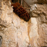
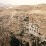
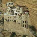
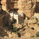
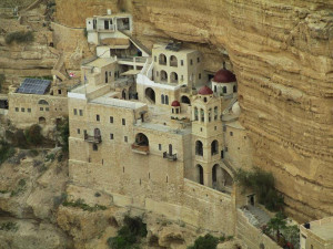
Monastery of St George in Wadi Qelt (Avishai Teicher / PikiWiki Israel)

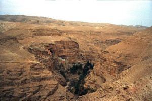
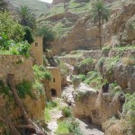
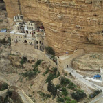
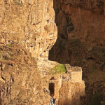
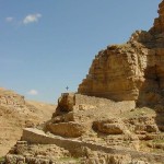
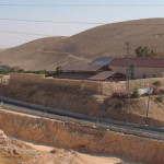
The spectacle of the Monastery of St George — a cliff-hanging complex carved into a sheer rock wall in the Judaean Desert, overlooking an unexpectedly lush garden with olive and cypress trees — is one of the most striking sights of the Holy Land.

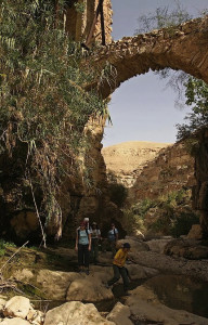
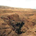
The monastery’s picturesque setting is in a deep and narrow gorge called Wadi Qelt, in a cliff face pocked with caves and recesses that have offered habitation to monks and hermits for many centuries.

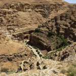
The wadi winds its deep and tortuous course for 35 kilometres between Jerusalem and Jericho — for most of the way providing a route for the Roman road on which Jesus set the parable of the Good Samaritan (Luke 10:25-37).

Some also envisage it as the “valley of the shadow of death” in Psalm 23.

Monastery of St George

Wadi Qelt in Judaean Desert (Jerzy Strzelecki)

The monastery, founded in the 5th century, is about 9 kilometres from Jericho and about 20 kilometres from Jerusalem, and on a favourite trail for hikers.

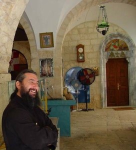
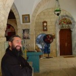
It is well known for its hospitality and, unlike most Greek Orthodox monasteries, welcomes female pilgrims and visitors — following a precedent set when a Byzantine noblewoman claimed the Virgin Mary had directed her there for healing from an incurable illness.


St George came from Cyprus

The monastery was founded in the 5th century when John of Thebes, an Egyptian, drew together a cluster of five Syrian hermits who had settled around a cave where they believed the prophet Elijah was fed by ravens (1 Kings 17:5-6).

Monastery of St George

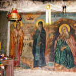
Hospitable Greek Orthodox monk at Monastery of St George (Don Schwager)

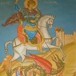
But it is named after its most famous monk, St George of Koziba, who came as a teenager from Cyprus to follow the ascetic life in the Holy Land in the 6th century, after both his parents died.

Another tradition links a large cave above the monastery with St Joachim, father of the Virgin Mary. He is said to have stopped to lament the barrenness of his wife, St Anne — until an angel arrived to tell him she would conceive.

The monastery went through the phases of destruction in the 7th century by the Persians (who martyred all 14 resident monks), rebuilding in the 12th century by the Crusaders, then disuse after the Crusaders were expelled from the Holy Land.

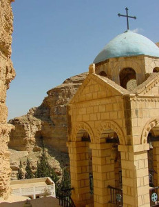
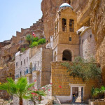
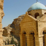
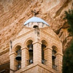
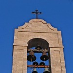
Complete restoration was undertaken by a Greek monk, Callinicos, between 1878 and 1901. The bell tower was added in 1952.

Monastery of St George

Bell tower at Monastery of St George (Don Schwager)

In 2010 a new road improved access, but visitors must walk down a steep and winding path for about 15 minutes (or hire a donkey from local Bedouin) to reach the monastery.

Just a handful of monks remain at St George’s, one of only five monasteries still functioning in the Judaean Desert.


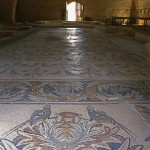
Mosaic floor from 6th century

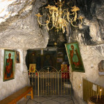
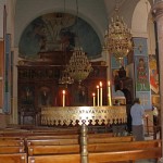
The three-level monastery complex encompasses two churches, the Church of the Holy Virgin and the Church of St George and St John. They contain a rich array of icons, paintings and mosaics.

In the ornate Church of the Holy Virgin, the principal place of worship, a mosaic pavement depicts the Byzantine double-headed eagle in black, white and red. The royal doors in the centre of the relatively modern iconostasis date from the 12th century.

Monastery of St George

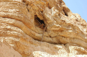
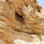
Precarious access to monk’s cave in Wadi Qelt (Sir Kiss)

The Church of St John and St George has a 6th-century mosaic floor. A reliquary contains the skulls of the 14 monks martyred by the Persians, and a glass casket encloses the incorrupt remains of a Romanian monk who died in 1960. A niche contains the tomb of St George.

The monastery also holds the tombs of the five hermits who began the monastery.

Stairs from the inner court of the monastery lead to the cave-church of St Elijah. From this cave, a narrow tunnel provides an escape route to the top of the mountain.

Monastery of St George

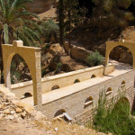
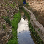
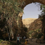
Aqueduct crossing Wadi Qelt (© vizAviz)

The view from the balcony of the inner court includes Roman aqueducts supported by massive walls on the other side of the wadi.


Administered by: Greek Orthodox Patriarchate of Jerusalem

Tel.: 054 7306557

Open: 9am-1pm; Sunday closed.


References

Bourbon, Fabio, and Lavagno, Enrico: The Holy Land Archaeological Guide to Israel, Sinai and Jordan (White Star, 2009)
Cohen, Daniel: The Holy Land of Jesus (Doko Media, 2008)
Freeman-Grenville, G. S. P.: The Holy Land: A Pilgrim’s Guide to Israel, Jordan and the Sinai (Continuum Publishing, 1996)
Giroud, Sabri, and others, trans. by Carol Scheller-Doyle and Walid Shomali: Palestine and Palestinians (Alternative Tourism Group, 2008)
Murphy-O’Connor, Jerome: The Holy Land: An Oxford Archaeological Guide from Earliest Times to 1700 (Oxford University Press, 2005)
Rossing, Daniel: Between Heaven and Earth: Churches and Monasteries of the Holy Land (Penn Publishing, 2012)

 

External links

St. George’s Monastery, Wadi Kelt (360cities)

Inn of the Good Samaritan

West Bank


Though the Inn of the Good Samaritan existed only in a parable, a real-life site was proposed in the early Christian centuries to edify the faith of pilgrims.

Inn of the Good Samaritan

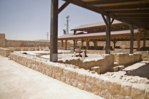
Entrance to Museum of the Good Samaritan (Josh Evnin)

The location, beside the road going down from Jerusalem to Jericho, fitted Jesus’ parable about the man who “fell into the hands of robbers, who stripped him, beat him, and went away, leaving him half dead” (Luke 10:25-37).

In the 6th century a Byzantine monastery with pilgrim accommodation was erected on the site of what was probably some sort of travellers’ hostel well before the time of Jesus. Later the Crusaders established a fortress on a nearby hill to protect pilgrims against robbers.

The remains of the monastery, about 18 kilometres from Jerusalem, became an Ottoman caravanserai and then served as a police post during the 20th century.

Inn of the Good Samaritan

Archaeological site and (at rear) worship area (© Whitecapwendy)

In 2009 Israel built a mosaic museum on the site — a matter of controversy since the area is in the West Bank and under Israeli military and civil control.

The remains of the monastery church were reconstructed as a space for worship, with an altar but no cross or other visible Christian symbol.


Road was notorious for robbers

Inn of the Good Samaritan

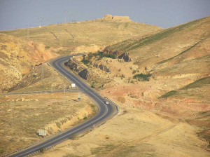
Modern road from Jerusalem down to Jericho in vicinity of Inn of the Good Samaritan (© Custodia Terrae Sanctae)

Jesus would have been familiar with the road. He would often have walked it on the final stretch of the way from Galilee to Jerusalem along the Jordan Valley.

It was here that the Mount of Olives and Mount Scopus gave travellers from Jericho their first glimpse of Jerusalem.

The rocky desert terrain around where the Inn of the Good Samaritan now stands was notorious for robbers. The local name for the area — Ma‘ale Adummim (“ascent of the red rocks”) — came from patches of limestone tinted red by iron oxide, but also suggested bloody raids by bandits.

Inn of the Good Samaritan

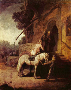
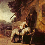
The Good Samaritan, depicted on arrival at the inn, by Rembrandt van Rijn, 1630 (Wallace Collection, London)

In the parable, a priest and a Levite saw the man who had been robbed but “passed by on the other side”. But a travelling Samaritan was “moved with pity”, tended the man’s wounds, took him to an inn and paid for his care.

The 12,000 Jericho-based priests and Levites used the road whenever they were rostered to serve in the Temple. But a traveller from Samaria would have been regarded as an alien in Judea.

So Jesus chose an unlikely hero — one whose people were at enmity with the Jews — to demonstrate that loving one’s neighbour requires expanding the definition of neighbour to include even an enemy.


Mosaics come from synagogues and churches

Inn of the Good Samaritan

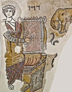
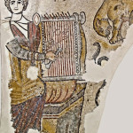
King David playing harp, mosaic at Museum of the Good Samaritan (© Israel Ministry of Tourism)

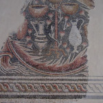
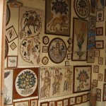
The museum is one of the largest in the world devoted to mosaics. Displays both indoors and outdoors include mosaics from Jewish and Samaritan synagogues, as well as from Christian churches, in Israel, the West Bank and Gaza.

Some of the mosaics date back to the 4th century AD. Many have been removed from archaeological sites, while others have been partly or wholly reconstructed.

The designs include rich geometric patterns, birds and flowers. Some have Greek, Hebrew or Samaritan inscriptions.

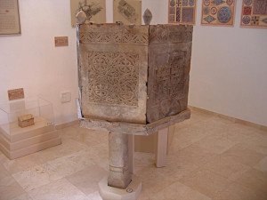
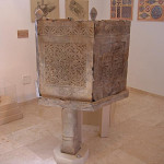
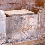
Displays also include findings from a nine-year archaeological excavation in the area. Among them are pottery, coins and stone coffins from the 1st century BC, and a carved pulpit, a case for holy relics and a dining table from the Byzantine era.


In Scripture:

Inn of the Good Samaritan

Byzantine church pulpit in Museum of the Good Samaritan (Yair Talmor)

Parable of the Good Samaritan: Luke 10:25-37

Administered by: Israel Nature and Parks Authority

Tel.: 972-2-6338230

Open: Sunday-Thursday and Saturday, 8am-4pm; Friday and holiday eves, 8am-3pm; eves of Rosh Hashanah, Yom Kippur and Passover, 8am-1pm.


References

Gonen, Rivka: Biblical Holy Places: An illustrated guide (Collier Macmillan, 1987)
Lefkovits, Etgar: “Mosaic museum opens in the W. Bank”, Jerusalem Post, June 7, 2009
Mackowski, Richard M.: Jerusalem: City of Jesus (William B. Eerdmans, 1980)
Prag, Kay: Jerusalem: Blue Guide (A. & C. Black, 1989)
Wareham, Norman, and Gill, Jill: Every Pilgrim’s Guide to the Holy Land (Canterbury Press, 1996)


External links

The Inn of the Good Samaritan (BibleWalks)

Petra

Jordan

Petra

Pilgrims holding a service in Petra Church (Seetheholyland.net)


The “rose-red city” of Petra in southern Jordan, famous for its rock-cut monumental buildings, was once the setting for a thriving Christian community with several significant churches.

An early account tells of Christians in Petra being martyred during the persecution of emperor Diocletian at the beginning of the 4th century, for refusing to offer sacrifice to Roman gods.

Nevertheless, a Christian presence persisted. Bishops from Petra attended Church synods and councils from AD 343, indicating that the city had become a significant Christian centre.

Crosses chiselled into sandstone walls show which large tombs were converted into churches. Then a succession of new churches was built.

Petra

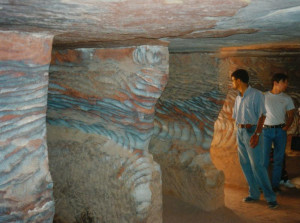
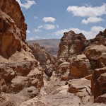
Multicoloured sandstone at Petra (Seetheholyland.net)

The Roman historian Epiphanius mentions that the conversion of Petra’s residents was a slow process throughout the late 4th and 5th centuries.

Then a monk called Mar Sauma arrived with 40 brother monks in AD 423. They found the gates locked against them, but a rainstorm struck with such intensity that part of the city wall was broken, allowing them in. Since the storm had broken a four-year drought, the water-dependent Nabateans saw the event as miraculous and even pagan priests converted to Christianity.


Exotic animals in mosaics

Three churches from the Byzantine era — called the Petra Church, the Blue Chapel and the Ridge Church — have been discovered. They are clustered on the ridge to the north-east of the Colonnaded Street that runs through Petra’s main city area, past the Temple of the Winged Lions.

Petra

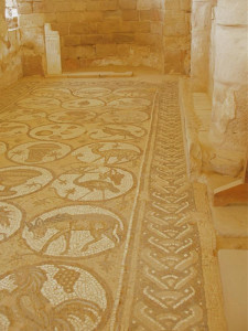
Aisle of mosaics in Petra Church (Seetheholyland.net)

The large triple-aisled Petra Church, a basilica dedicated to St Mary, was probably the ancient city’s cathedral.

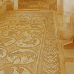
Little of the interior remains except for well-preserved mosaics carpeting the 70-square-metre floors of each of the side aisles. These depict local, exotic and mythological animals, as well as personifications of the Seasons, Ocean, Earth and Wisdom.

The secular nature of these mosaics is probably explained by a reluctance to tread on sacred images.

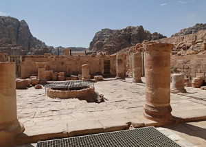
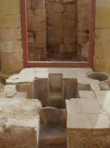
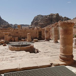
Just west of the church proper is a stone-paved atrium, with a cistern sunk into the centre to catch water. Further west is a baptistery, with a cross-shaped baptismal font.

The basilica was destroyed by a fire, probably in the early 7th century.


Scrolls revealed business deals

Petra

Petra Church atrium and water cistern (Bernard Gagnon)

The fire that destroyed the Petra Church also carbonised an invaluable hoard of papyrus scrolls cached in a church storeroom. The 152 scrolls — the largest collection of written material from antiquity found in Jordan — lay undiscovered until 1993.

Written mainly in cursive Greek, they have been painstakingly deciphered to reveal details of births, prenuptial arrangements, marriages, business deals, wills, properties disputes and tax responsibilities of about 350 members of the community.

One of the main figures identified in the scrolls is Theodorus, who married his cousin Stephanous in 537, when he was aged about 24. Later ordained a deacon in the Petra diocese, Theodorus was also a successful landowner with extensive business interests.

Petra

Baptistery of Petra Church (Seetheholyland.net)

A son of Theodorus is recorded as being responsible for paying local taxes on a vineyard — at the rate of 47.5 per cent! This affluent family apparently owned much property in the Petra region.


Church overlooked the city

The Ridge Church had a commanding position, with a 360-degree view of the central city, atop the northern slope of the valley in which Petra sits.

The oldest church in the city, dating from the 4th century, it had two side aisles separated from the nave by five columns on each side.

Behind it, city walls across the valley would have protected Petra against invasion from the north.

Petra

Granite columns at Blue Church (David Loong)

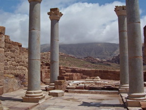
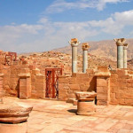
Between the Petra Church and the Ridge Church is the Blue Chapel, so named after its four blue Egyptian granite columns, topped with Nabataean horned capitals, that collapsed in an 8th-century earthquake but have been re-erected.

The chapel also had blue sandstone flooring and blue marble furnishings — including a blue marble pulpit.

This building is believed to have been converted into a residence and chapel for Petra’s bishop.


Tombs and temples were converted

Other buildings converted to Christian churches include the Urn Tomb and al-Deir (Arabic for “the Monastery”).

Petra

Urn Tomb at Petra (Chris Yunker)

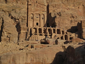
The Urn Tomb, the first of the four Royal Tombs just north of the amphitheatre, still bears an inscription to “Christ the Saviour” on one of its inside walls.

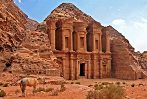
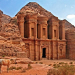
Al-Deir, the biggest and most grandiose monument in Petra, is in the hills overlooking the city from the north-west. A visit involves a walk of about an hour from the city centre, up 800 rock-cut steps.

At 50 metres wide and 45 metres high, it is much bigger than al-Khazneh (“the Treasury”) — the famous monument that appears to visitors arriving through the gorge called the Siq (and in which the climax of the 1989 film Indiana Jones and the Last Crusade was set).

Originally cut out of the rock to serve as a mortuary temple, al-Deir was apparently later adapted to Christian use. It seems to have acquired its name of the Monastery from the crosses painted and inscribed on its inner walls.

Two Greek monks were recorded as living in the building in 1217.


Petra was in biblical Edom

Petra

Al-Deir, Petra’s biggest monument (Dennis Jarvis)

In biblical times Petra was a city of the Edomites, whose ancestor Esau settled there after he was tricked out of his rightful inheritance by his twin brother Jacob.

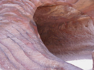
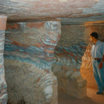
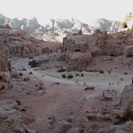
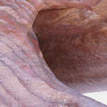
By the middle of the second century BC, the Edomites had been displaced by the Nabataeans. These former nomad herdsmen made Petra their multicoloured sandstone capital city, transforming it into a desert oasis by using ingenious aqueducts and cisterns to conserve water from flash floods.

The Nabataeans also controlled trade routes from Arabia to Mesopotamia and Syria, exacting high tolls from caravans which passed their way.

Petra

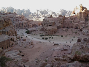
Overview of some of Petra’s monuments (Chris Yunker)

One tradition has the Three Wise Men buying their gold, myrrh and frankincense at Petra on their way to Bethlehem.

The greatest Nabataean king was Aretas IV (9 BC to AD 40), whose rule extended as far north as Damascus. His daughter Phasaelis was married to Herod Antipas, who divorced her to marry Herodias, his brother’s wife. Aretas IV then marched on Herod’s army, defeated it and captured territories along the West Bank of the Jordan River.

After his conversion, St Paul stays he spent time in “Arabia” (Galatians 1:17) — the name then given to the territory of the Nabateans — where he probably began his commission to preach the Gospel to pagans. It was Aretas IV who was pursuing him when Paul later escaped Damascus by being lowered in a basket from the city wall.

In AD 106 Petra was annexed by the Roman empire. Rome’s diversion of the caravan trade and some devastating earthquakes in subsequent centuries put the city into decline.


Poet recanted his rosy view

From the 13th century Petra was abandoned. It remained forgotten by the Western world until 1812 when a young Swiss explorer, Johann Ludwig Burckhardt, disguised as an Arab pilgrim, persuaded a local guide to take him there.

Petra

Pink sandstone cave at Petra (Seetheholyland.net)

Burckhardt’s published account inspired the English clergyman John William Burgon to write his prize-winning poem Petra, with its line “A rose-red city — half as old as Time!”

The poem, published in 1845, ran to 366 lines — much longer than the extract generally offered in anthologies.

Burgon, who later became dean of Chichester Cathedral, had never visited Petra when he composed his poem. He did so in 1862, describing it in a letter to his sister as “the most astonishing and interesting place I ever visited”. However, perhaps reflecting his ill health at the time, he added: “But there is nothing rosy in Petra by any means.”

Administered by: Petra Development and Tourism Regional Authority

Tel.: +962 (0)3 215-6020 (Visitors’ Centre)

Open: 6am-6pm (4pm in winter)

References

Basile, Joseph J.: “When People Lived at Petra”, Biblical Archaeology Review, July/August 2000
Bikai, Patricia Maynor: “The Churches of Byzantine Petra”, Near Eastern Archaeology, December 2002
Bourbon, Fabio, and Lavagno, Enrico: The Holy Land Archaeological Guide to Israel, Sinai and Jordan (White Star, 2009)
Burckhardt, Johann Ludwig: Travels in Syria and the Holy Land (John Murray, 1822)
Burgon, John William: Petra, a prize poem (Oxford, 1845)
Dyer, Charles H., and Hatteberg, Gregory A.: The New Christian Traveler’s Guide to the Holy Land (Moody, 2006)
Freeman-Grenville, G. S. P.: The Holy Land: A Pilgrim’s Guide to Israel, Jordan and the Sinai (Continuum Publishing, 1996)
Gochis, Djinna, and Michaels, Christine: “Mysterious Petra Rediscovered”, Catholic Near East Magazine, fall 1978
Goulburn, Edward Meyrick: John William Burgon, late Dean of Chichester : a biography, volume 1 (J. Murray, 1892)
Milne, Mary K.: “Rose-Red City, Half as Old as Time”, CNEWA World, September/October 2002
Murphy-O’Connor, Jerome: “What was Paul Doing in ‘Arabia’?”, Bible Review, October 1994


External links

Rose-Red City, Half as Old as Time (CNEWA)
Petra: The Churches (Nabataea.net)


Sepphoris

Israel


Sepphoris

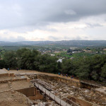
Sepphoris with Nazareth on hill in distance (Steve Peterson)

Sepphoris, a ruined city 6.5 kilometres northwest of Nazareth, was the capital of Galilee during the time of Jesus. Though it is not mentioned in the New Testament, it is of interest to Christian pilgrims for two main reasons:

•  The rebuilding of the city by Galilee’s ruler, Herod Antipas, may have attracted the building tradesman Joseph and his wife Mary to settle in Nazareth when they returned with Jesus from Egypt.

This major building site, 50 minutes’ walk from Nazareth, would have offered Joseph many years of employment. It may also be where Jesus gained insights into the building trade — such as the need to build with foundations on rock rather than on sand (Luke 6:48-49).

•  According to tradition, the original home of Mary’s parents, Joachim and Anne (or Anna), was at Sepphoris. During the 12th century the Crusaders built a huge Church of St Anna, possibly on the site of their home.

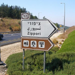
Sepphoris rose to prominence during the century before Christ because it overlooked two major highways. A mainly Jewish city, it was given its Hebrew name, Zippori, because it sits on a hilltop like a bird (zippor).

According to the historian Josephus, Herod Antipas made it “the ornament of Galilee”, a term also implying the military connotation of an impregnable city.

Sepphoris

Pilgrims on Decumanus street at Sepphoris (Seetheholyland.net)

After the destruction of Jerusalem in AD 70, Sepphoris became a centre of Jewish learning and seat of the Sanhedrin supreme court. The Mishnah, the first authoritative collection of Jewish oral law, was compiled here.

A Christian community was present by the 4th century. By the 6th century it was sufficiently large to have its own bishop.

It was from Sepphoris that the Crusaders rode out in 1187 for their defeat by the Muslim sultan Saladin at the Horns of Hattin, overlooking the Sea of Galilee — a defeat that brought about the end of the Crusader Kingdom of Jerusalem.


Many changes of name

Sepphoris has worn many names during its history.

It was Zippori (or Tzippori) when Herod the Great captured it during a snowstorm in 37 BC. After Herod’s death in 4 BC the Roman army put down a rebellion of Jewish rebels by destroying the city and selling many of its people into slavery.

When Herod’s son Herod Antipas rebuilt the city, he renamed it Autocratoris.

Because the inhabitants chose not to join the First Jewish Revolt against Rome in AD 66-73, the city was spared the destruction suffered by other Jewish centres, including Jerusalem. Evidence of the city’s pacifist stance comes from coins inscribed “City of Peace” minted there during the revolt.

Before the Second Jewish Revolt in 132-135, the Romans changed the name to Diocaesarea. A massive earthquake in 363 devastated the city and it was only partly rebuilt.

The Muslim conquest in the 7th century saw another name change, to Saffuriya. Except for a period as La Sephorie under the Crusaders, this name remained for what became an Arab village until the population of about 4000 fled attacks by Israeli forces during the 1948 Arab-Israeli War.


Three apses of church still stand

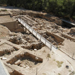
Excavations at Sepphoris have uncovered streets, houses, public buildings, bathhouses, a market, two churches, a synagogue, a Roman theatre, aqueducts, a huge elongated water reservoir (260 metres long) and more than 40 mosaic floors.

Sepphoris

Crusader fortress overlooking Sepphoris (© Ori~ / Wikimedia)

A Crusader fortress, built on the remains of an earlier structure, dominates the upper part of the site and provides a panoramic view from its roof. It now houses a museum.

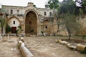
To the west of the summit, on the northwestern perimeter of Sepphoris National Park, are the remains of the Crusader Church of St Anna. Inside a walled enclosure, the three apses are still standing, now incorporated into the western wall of a modern Monastery of the Sisters of St Anne (where the key to the enclosure is available).

Northeast of the fortress is the Roman theatre, its tiers of 4500 seats carved into the northern slope of the hill.

Sepphoris

Remains of Church of St Anna at Sepphoris (© Custodia Terrae Sanctae)

Biblical scholars have conjured with the possibility that Jesus might have known this theatre and even taken from it the word “hypocrite” — Greek for one who is play-acting — which he frequently used (in Matthew 6, for example). But archaeologists are uncertain whether the theatre was in use when Jesus lived in Nazareth.

On the northern edge of the park are remains of a 6th-century synagogue with a mosaic floor depicting biblical scenes, Temple rituals and a zodiac wheel.


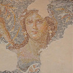
Mosaic portrait dubbed “Mona Lisa”

Just south of the Roman theatre stood a palatial mansion built in the 3rd century AD. Known as the Dionysus House, it was destroyed by the earthquake in 363, but the remarkable mosaic carpet in its stately dining room survived well-preserved under the debris.

The 15 centre panels depict scenes from the life of Dionysus, the Greek god of wine and revelry, bordered by medallions of acanthus leaves with hunting scenes.

Sepphoris

“Mona Lisa of the Galilee” in Roman mansion at Sepphoris (Seetheholyland.net)

Each scene is labelled with a Greek word — a panel displaying a completely inebriated Hercules is labelled MEQH, meaning drunkenness.

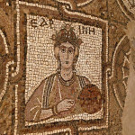
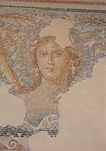
But the most remarkable feature of the mosaic floor is an elegant portrait of an unknown woman at the centre of one end. The engaging tilt of her head and enigmatic expression have earned her the nickname “Mona Lisa of the Galilee”.

The unknown artist of this portrait used tiny stones, in a wide range of natural colours, and with an exquisite attention to detail and shading.


Elegant mosaics illustrate life on River Nile

An impressive network of well-planned streets has been exposed in the lower city. Two major intersecting streets, the north-south Cardo and the east-west Decumanus, had covered footpaths and shops on both sides.

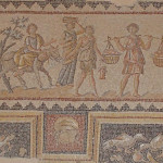
East of the Cardo, a large building called the Nile House had some 20 rooms decorated with multi-coloured mosaic floors. The most elegant depict scenes associated with the River Nile in Egypt.

Sepphoris

Nilometer and river scenes in Sepphoris mosaic (Seetheholyland.net)

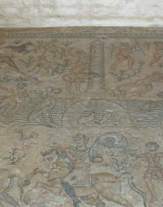
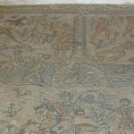
In the most impressive mosaic, the river flows through the picture and wildlife such as fish and birds are seen along its banks. On the left a reclining female figure with a basket of harvest fruits personifies Egypt; on the right a male figure represents the Nile.

In the centre a man standing on a woman’s back records 17 cubits (about 8 metres) on a nilometer — a pillar with a scale to measure the height of the Nile during its seasonal flood.

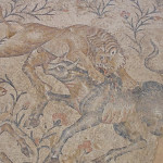
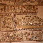
The lower portion shows hunting scenes: A fierce lion pouncing on the back of a bull, a panther leaping on a gazelle, and a boar being attacked by a bear.

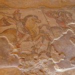
Other mosaics in the building include a depiction of Amazon warriors hunting from horseback.


Administered by: Israel National Parks Authority

Tel.: 04-656-8272

Open: 8am-5pm (4pm Oct-Mar) with last entry one hour earlier; closes at 3pm on Fridays and eves of Jewish holidays.


References

Bourbon, Fabio, and Lavagno, Enrico: The Holy Land Archaeological Guide to Israel, Sinai and Jordan (White Star, 2009)
Chancey, Mark, and Meyers, Eric M.: “Spotlight on Sepphoris: How Jewish was Sepphoris in Jesus’ Time?”, Biblical Archaeology Review, July/August 2000
Charlesworth, James H.: The Millennium Guide for Pilgrims to the Holy Land (BIBAL Press, 2000)
Charlesworth, James H.: Jesus and Archaeology (Wm. B. Eerdmans, 2006)
Freeman-Grenville, G. S. P.: The Holy Land: A Pilgrim’s Guide to Israel, Jordan and the Sinai (Continuum Publishing, 1996)
Kochav, Sarah: Israel: A Journey Through the Art and History of the Holy Land (Steimatzky, 2008)
Losch, Richard R.: The Uttermost Part of the Earth: A guide to places in the Bible (Wm. B. Eerdmans, 2005)
Murphy-O’Connor, Jerome: The Holy Land: An Oxford Archaeological Guide from Earliest Times to 1700 (Oxford University Press, 2005)
Shahin, Mariam, and Azar, George: Palestine: A guide (Chastleton Travel, 2005)
Walker, Peter: In the Steps of Jesus (Zondervan, 2006)
Weiss, Ze’ev. “The Sepphoris Synagogue Mosaic”, Biblical Archaeology Review, September/October 2000
Weiss, Ze’ev, and Tsuk, Tsvika: Zippori National Park (Israel Nature and Parks Authority leaflet)

External links

Sepphoris (BibleWalks)
Sepphoris (BiblePlaces)
Sepphoris (The Bible and Interpretation)
The USF Excavations at Sepphoris (CenturyOne Foundation)
Zippori — “The Ornament of All Galilee” (Israel Ministry of Foreign Affairs)

Madaba

Jordan

Madaba

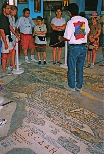
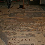
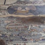
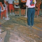
Guide explains mosaic map in Church of St George, Madaba (Seetheholyland.net)

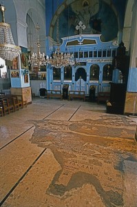
The remains of the oldest known map of the Holy Land, painstakingly assembled from more than a million pieces of coloured stone, lie on the floor of a church in the Jordanian city of Madaba.

This unique art treasure was designed by an unknown artist and constructed in a Byzantine cathedral in the middle of the 6th century.

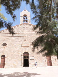
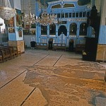
It was rediscovered only in 1884, but its unique character was recognised only in 1896, after the new Greek Orthodox Church of St George had been built over it.

The discovery of the Madaba Mosaic Map, and mosaics in the remains of five more churches and other locations in the town, led to Madaba, 30km south of Amman, becoming known as “the City of Mosaics”.

The map originally covered an area of more than 15.5 metres by 5.5 metres with a geographic sweep from Lebanon in the north to the Nile delta in the south. Less than a third of the map has survived.

In spite of some inaccuracies, it is regarded as the most exact map of the Holy Land before modern cartography was developed.


Jerusalem is the main feature

Madaba

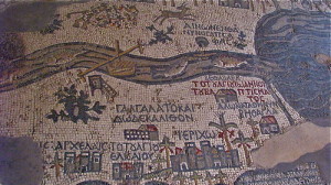
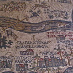
Madaba map showing fish in Jordan River (Dale Gillard)

Unlike modern maps, which face north, the Madaba mosaic is orientated to the east, with the Jordan River flowing from left to right.

Using a palette consisting of coloured stones and glass, the artist ingeniously depicted biblical locations, regional names and events, labelling them with about 150 inscriptions in Greek.

There is Jericho ringed with palm trees, Jacob’s Well at Shechem, the Oak of Mamre at Hebron, John’s baptism of Jesus in the Jordan River, and the allotments of the 12 tribes of Israel.

East of the Jordan River, a lion pursues a graceful gazelle. Fish swim down the river, with one turning back against the flow to avoid the poisonous Dead Sea. Two pulley-drawn ferries cross the river. Two boats cross the Dead Sea, one being rowed and the other under sail.

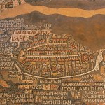
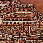
But the artist’s dominant focus is on the “Holy City” of Jerusalem. A lavish bird’s-eye view of the city is presented, with its walls, gates, main streets and 36 specific buildings represented. Many of the buildings (including the Church of the Holy Sepulchre) are clearly identifiable.


Purpose of map is debated

Scholars have differing opinions on why such an expensive piece of religious art should have been commissioned by Church authorities on the floor of a Christian building in a provincial town of the Roman Empire.

St George's Church, Madaba (Seetheholyland.net)

St George’s Church, Madaba (Seetheholyland.net)

Some of the possibilities debated are:

• To aid pilgrims in making their way from one holy place to another. But pilgrims could not take this map with them, and portable maps and local guides were available at the time.

• To represent Moses’ vision of the Promised Land. Moses glimpsed the Promised Land from the top of nearby Mount Nebo, and Madaba was the episcopal see of the bishopric to which Mount Nebo belonged.

• To enhance the spiritual experience of worshippers during liturgy. The mosaic was originally on the floor of a large church, stretching across between the priest at the altar and the congregation.

The contents of the map indicate that it was intended as a work of biblical geography, probably based on the Onomasticon of Eusebius, a gazatteer of placenames, as well as on pilgrims’ journals and the artist’s own knowledge of the land.

The importance given to Christian holy places, especially the Church of the Holy Sepulchre, rather than Old Testament locations, suggests that the map is a Christian exposition of the message of salvation in a geographic context.


Madaba in ruins for centuries

Madaba

Mosaic map in Church of St George (© Visitpalestine.ps)

Madaba was an important town in the early centuries of the Christian era. It was on the King’s Highway trade route, it had its own bishop and it had about 10 other churches with impressive mosaics. The remains of two of these churches are in the city’s archaeological park.

A conservative estimate is that the mosaic map would have originally contained about 1,116,000 pieces of stone and glass. A team of three workmen, working 10-hour days and directed by a superior artist, would have needed about 186 days to assemble it.

In 746, about 200 years after the mosaic map was constructed, Madaba was largely destroyed by an earthquake and subsequently abandoned.

The town was still in ruins and uninhabited in the early 1880s when a group of Christians from Karak, 140km south of Amman, decided to move there to escape conflict with Muslims in their home town.

The new settlers were removing debris from an old church in 1884, so they could build a new one on the site, when they discovered the remains of the map. They incorporated the surviving fragments into the new St George’s Church.

The map’s extraordinary value was not recognized until the librarian of the Greek Orthodox patriarchate in Jerusalem, Fr Kleopas Koikylides, visited in 1896. A report he published the following year brought international attention to the dusty village of Madaba.

By the middle of the 19th century the mosaic was in poor condition. Restoration and conservation was carried out by archaeologists Herbert Donner and Heinz Cüppers in 1965.

Madaba is now the fifth most populous city in Jordan and the administrative centre for the territory south of Amman. St George’s Church is northwest of the city centre.


Administered by: Greek Orthodox Church

Tel.: 962-5-324-4984

Open: Sat, Mon-Thur 8am-6pm; Fri 9.30am-6pm; Sun 10.30am-6pm (5pm closing in winter)


References

Donner, Herbert: The Mosaic Map of Madaba: an introductory guide (Kok Pharos, 1992)
Haddad, Fadi Shawkat: A Christian Pilgrimage Journey in Jordan (published by author, PO Box 135, Amman 11733, 2015)
Inman, Nick, and McDonald, Ferdie (eds): Jerusalem & the Holy Land (Eyewitness Travel Guide, Dorling Kindersley, 2007)
Piccirillo, Michele: “The Madaba Mosaic Map”, Holy Land, winter 2002


External links

Madaba (Wikipedia)
Madaba (VisitJordan)
All content © 2022, See the Holy Land | Site by Ravlich Consulting & Mustard Seed
You are welcome to promote site content and images through your own
website or blog, but please refer to our Terms of Service | Login