. . . your guide to visiting the holy places  
If you have found See the Holy Land helpful and would like to support our work, please make a secure donation.
The Sites

Israel and Palestine – In Jerusalem

Israel and Palestine – Outside Jerusalem

Jordan

Egypt

Extras

Mount of Temptation

West Bank


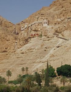
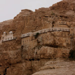
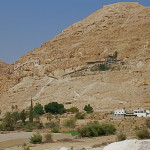
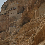
The Mount of Temptation, with a gravity-defying monastery clinging to its sheer face, is traditionally regarded as the mountain on which Christ was tempted by the devil during his 40-day fast.

Mount of Temptation

Monastery of the Temptation with cable cars immediately below it (Seetheholyland.net)

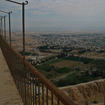
The summit of the mount, about 360 metres above sea level, offers a spectacular panoramic view of the Jordan Valley, the Dead Sea and the mountains of Moab and Gilead.

The Mount of Temptation is about 5km north-west of the West Bank city of Jericho. Access to the summit is by a 30-minute trek up a steep path — passing through the cliffhanging monastery on the way — or by a 5-minute cable car ride from Tel Jericho.

Unlike some Greek Orthodox monasteries, the Monastery of the Temptation allows women visitors as well as men.

The mountain is also known as Mount Quarantania and Jebel Quarantul. Both names arise from a mispronunciation of the Latin word Quarentena, meaning 40, the number of days in Christ’s fast. This period of fasting became the model for the practice of Lent in Christian churches.


Temptations on the mount

Mount of Temptation

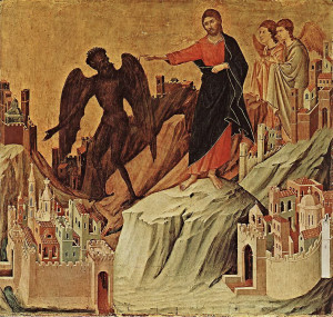
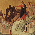
The Temptation on the Mount, by Duccio di Buoninsegna (Museo dell’Opera del Duomo, Siena)

As recorded in the Gospels of Matthew (4:1-11) and Luke (4:1-13) — and fleetingly in Mark (1:12-13) — the Holy Spirit led Jesus into the desert. While he fasted, the devil tempted him three times to prove his divinity by demonstrating his supernatural powers.

Each time, Jesus rebuffed the tempter with a quotation from the Book of Deuteronomy. Then the devil left and angels brought food to Jesus, who was famished.

Tradition dating from the 12th century places two of the devil’s temptings on the Mount of Temptation.

The temptation to turn a stone into bread is located in a grotto halfway up the mountain. The offer of all the kingdoms of the world in return for worshipping the devil is located on the summit.


Monks turned caves into cells

Mount of Temptation

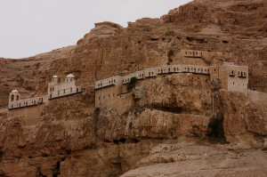
Monastery of the Temptation (Dmitrij Rodionov / Wikimedia)

Monks and hermits have inhabited the mountain since the early centuries of Christianity. They lived in natural caves, which they turned into cells, chapels and storage rooms. A sophisticated system of conduits brought rainwater from a large catchment area into five caves used as reservoirs.

A 4th-century Byzantine monastery was built on the ruins of a Hasmonean-Herodian fortress. The monks abandoned the site after the Persian invasion of 614.

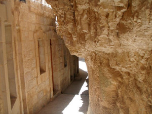
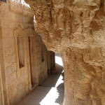
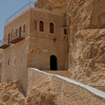
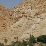
The present Monastery of the Temptation, reconstructed at the end of the 19th century, seems to grow out of the mountain. The northern half is cut into the almost sheer cliff, while the southern half is cantilevered into space.

Mount of Temptation

Cliff into which monastery is built (Kourosh)

A medieval cave-church, on two levels, is built of masonry in front of a cave. In the monastery is a stone on which, according to tradition, Jesus sat during one of his temptations.

In the valley of this mountain, Jewish priests and Levites travelled the winding road from Jericho to Jerusalem when it was their turn to minister in the Temple. In the time of Jesus, about 12,000 priests and Levites lived in Jericho.


In Scripture

Jesus is tempted by the devil: Matthew 4:1-11, Luke 4:1-13


Administered by: Greek Orthodox Church

Tel.: 972-2-2322827

Open: Monastery, Mon-Fri 9am-1pm, 3-4pm; Sat 9am-2pm; Sun closed


References

Gonen, Rivka: Biblical Holy Places: An illustrated guide (Collier Macmillan, 1987)
Inman, Nick, and McDonald, Ferdie (eds): Jerusalem & the Holy Land (Eyewitness Travel Guide, Dorling Kindersley, 2007)
Kochav, Sarah: Israel: A Journey Through the Art and History of the Holy Land (Steimatzky, 2008)
Murphy-O’Connor, Jerome: The Holy Land: An Oxford Archaeological Guide from Earliest Times to 1700 (Oxford University Press, 2005)

External links

Temptation of Christ (Wikipedia)
« Newer PostsOlder Posts »

Stella Maris Monastery

Israel


Perched at the western edge of Mount Carmel, high above the Mediteranean and the coastal city of Haifa, is Stella Maris Monastery and church.

Stella Maris Monastery

Stella Maris Church on Mount Carmel (Ilan)

The name of the 19th-century monastery — Latin for “Star of the Sea” — refers not to the magnificent view, but rather to an early title accorded Mary, the mother of Jesus.

The monastery is the world headquarters of a Catholic religious order of friars and nuns, the Carmelites.

The order had its origins at the end of the 12th century when St Berthold, a Frenchman who had gone to the Holy Land as a Crusader, had a vision of Christ denouncing the evil done by soldiers.


Hermits lived in caves

Berthold gathered a small community of hermits around him, living in caves on Mount Carmel, in imitation of the Old Testament prophet Elijah. Later the community became known as the Hermit Brothers of St Mary of Mount Carmel.

Stella Maris Monastery

Eastern facade of Stella Maris Monastery (© Deror Avi / Wikimedia)

In 1206 the community received a written rule from St Albert of Jerusalem. In the same century, some members moved to Europe and established similar groups from Sicily to Oxford. Those who remained in the Holy Land were massacred by the Saracens in 1291.

Carmelites returned to Mount Carmel in 1631 and finally completed the Stella Maris Monastery in the 18th century. Its stout walls and small openings reflect the need for defence against hostilities during its establishment.

Later a lighthouse was built, giving a further meaning to the title Stella Maris. Because of its commanding position, the lighthouse has been commandeered as a military establishment.


Elijah connected to two grottoes

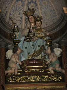
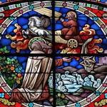
Inside the church, the décor features vividly coloured Italian marble and dramatic paintings in the dome, one depicting Elijah being swept up to heaven in a fiery chariot. A cedar and porcelain statue of Mary, Our Lady of Mount Carmel, is above the altar.

Stella Maris Monastery

Statue of Our Lady of Mount Carmel in Stella Maris Church (© George David Byers)

Steps lead down to a grotto, with a small altar, where the Old Testament prophet Elijah is believed to have occasionally lived. People have lived in caves on Mount Carmel since prehistoric times.

Opposite the monastery, a steep footpath down toward the Mediterranean leads to a larger grotto, Elijah’s Cave, where the prophet is said to have meditated before his victory over the prophets of Baal, described in 1 Kings 18: 1-40.

The cave — which is venerated by Jews, Christians and Muslims — is also thought to be where Elijah established a “school of prophets”, where his successor Elisha, among others, studied.

In the garden of Stella Maris Church, a monument is dedicated to wounded French soldiers who were killed by the Mamluk governor Ahmed Pasha el-Jazzar after Napoleon withdrew in 1799.


Other sites in the area:

Mount Carmel

Elijah’s Cave

Baha’i Shrine


In Scripture:

Elijah triumphs over the priests of Baal: 1 Kings 18:1-40

Elijah prays on Mount Carmel: 1 Kings 18:41-46

Administered by: Order of Carmelites

Tel.: 972-4-8337758

Open: 6am-12.30pm, 3-6pm


References

Blaiklock, E. M.: Eight Days in Israel (Ark Publishing, 1980)
Brownrigg, Ronald: Come, See the Place: A Pilgrim Guide to the Holy Land (Hodder and Stoughton, 1985)
Freeman-Grenville, G. S. P.: The Holy Land: A Pilgrim’s Guide to Israel, Jordan and the Sinai (Continuum Publishing, 1996)
Gonen, Rivka: Biblical Holy Places: An illustrated guide (Collier Macmillan, 1987)
Inman, Nick, and McDonald, Ferdie (eds): Jerusalem & the Holy Land (Eyewitness Travel Guide, Dorling Kindersley, 2007)


External links

Carmelite Monastery, Stella Maris (BibleWalks)
The Carmelites of the Holy Land
The Carmelite Order (Catholic Encyclopedia)
Order of Carmelites (Carmelite Order)


« Newer PostsOlder Posts »

Elijah’s Cave

Israel


The caves of Mount Carmel were well known to Elijah, the Old Testament prophet. Here he sometimes lived — and sometimes had to hide.

Elijah's Cave

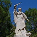
Statue of Elijah at Mukhraka (© Biblicalisraeltours.com)

On the northern slope of Mount Carmel, near the Haifa beach, is a cave where the prophet is believed to have meditated before his fateful encounter with the priests of Baal.

In this encounter, described in 1 Kings 18:1-40, Elijah issued a challenge to 450 pagan priests. Before an assembly on the summit of Mount Carmel, he called on the priests to seek fire from their god Baal to light a sacrifice.

When Baal failed to respond to their pleading, Elijah rebuilt the ruined altar of the Lord and offered his own sacrifice. Immediately fire from heaven consumed the offering, even though it had been soaked in water.


Venerated by four faiths

Elijah’s Cave can be approached by stairs from Allenby Road, near Haifa’s cable car. It is also accessible down a steep path from the Carmelite church on Stella Maris Road.

Elijah's Cave

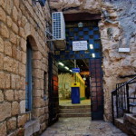
Entry to Elijah’s Cave, males to the right, females to the left (© BibleWalks.com)

The cave, about 14 metres long, is situated in a residential dwelling. It is open to the public, with separate areas for males and females. Adjacent buildings served as a hostel from the late 19th century.

Elijah is venerated by Jews, Christians, Muslims and Druze, all of whom come as pilgrims. Writings left by pilgrims in past centuries can be seen on the cave walls.

Curative properties have been ascribed to the cave over the years, including the curing of mental illnesses.

Possible site of ‘school of prophets’

Among the traditions associated with the cave is that Elijah hid here from the wrath of Jezebel, who had introduced worship of her Phoenician god Baal to the land.

Elijah's Cave

Women’s section of Elijah’s Cave (Daniel Ventura)

It is also thought that Elijah established a “school of prophets” here on his return from exile at Mount Sinai. If so, this would be where his successor Elisha, among others, studied.

No Old Testament prophet is referred to as frequently in the New Testament as Elijah. Both Jesus and John the Baptist were on occasions thought to be reincarnations of Elijah.

A small cave under Stella Maris Monastery, at the western edge of Mount Carmel, is held by a Christian tradition to be a place where Elijah also occasionally lived.

Other sites in the area:

Mount Carmel

Stella Maris Monastery

Baha’i Shrine


In Scripture:

Elijah triumphs over the priests of Baal: 1 Kings 18:1-40


Administered by: Israel Ministry of Religious Affairs

Open: Sun-Thur 8am-5pm, Fri 8am-1pm

References

Blaiklock, E. M.: Eight Days in Israel (Ark Publishing, 1980)
Brownrigg, Ronald: Come, See the Place: A Pilgrim Guide to the Holy Land (Hodder and Stoughton, 1985)
Freeman-Grenville, G. S. P.: The Holy Land: A Pilgrim’s Guide to Israel, Jordan and the Sinai (Continuum Publishing, 1996)
Gonen, Rivka: Biblical Holy Places: An illustrated guide (Collier Macmillan, 1987)
Inman, Nick, and McDonald, Ferdie (eds): Jerusalem & the Holy Land (Eyewitness Travel Guide, Dorling Kindersley, 2007)


External links

Elijah’s Cave, Carmel (BibleWalks)
Elijah’s Cave, Haifa (Sacred Destinations)


« Newer PostsOlder Posts »

Church of the Holy Sepulchre chapels

Jerusalem

Church of the Holy Sepulchre chapels

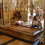
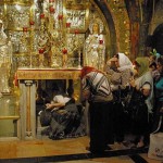
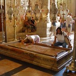
Pilgrims at the Stone of Anointing (Seetheholyland.net)

The Church of the Holy Sepulchre in the Old City of Jerusalem — venerated as the place where Jesus Christ died and rose again — contains a bewildering conglomeration of 30-plus chapels and worship spaces. There are no helpful signs.

This article describes the most significant areas that are not covered in the main Church of the Holy Sepulchre article.

The description begins at the main door (on the south side of the church) and circles the church in a roughly clockwise manner.

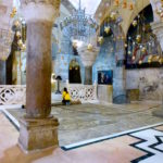
Immediately inside the main door is the Stone of Anointing, a slab of reddish stone flanked by candlesticks and overhung by a row of eight lamps. It commemorates the place where the body of Jesus was prepared for burial (though this stone dates only from 1810). It belongs
jointly to the Greek Orthodox, Catholics
and Armenian Orthodox.


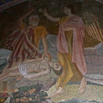
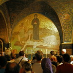
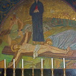
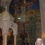
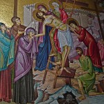
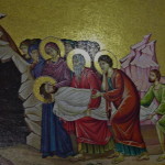
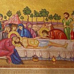
On the wall behind the stone, a Greek mosaic depicts (from right to left) Christ being taken down from the cross, his body being prepared for burial, and his body being taken to the tomb.

To the left of the Stone of Anointing is a small circular slab with four pillars surmounted by a marble canopy. This shrine is the Armenian Station of the Holy Women. It commemorates Jesus’ mother and her companions who viewed the crucifixion.

On the wall behind the shrine, a large mosaic recalls the scene. The Armenians’ sacristy is on the left.


‘Little house’ encloses tomb

Church of the Holy Sepulchre chapels

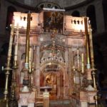
Dome above edicule of the Tomb of Christ (Seetheholyland.net)

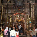
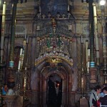
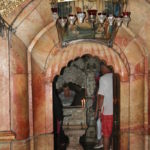
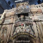
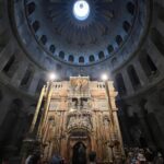
From this position the Tomb of Christ can be seen. A stone edicule (“little house”) encloses the sepulchre where it is believed Jesus lay buried for three days — and where he rose from the dead. (It is described in more detail in the Church of the Holy Sepulchre article.)

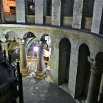
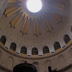
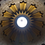
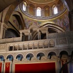
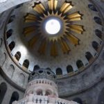
The lofty circular stone structure encompassing this whole area is known as the Rotunda. Above it is a huge dome decorated with a starburst of light.

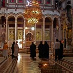
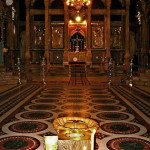
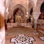
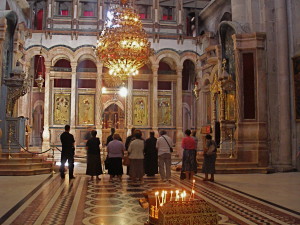
Opposite the entrance to the Tomb, a triumphal arch built by the Crusaders leads to the basilica’s central worship space, the Katholikon. Originally the choir of the 12th-century Crusader church, it is now the Greek Orthodox cathedral.

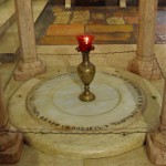
A highly decorated screen called the iconostasis partially hides the altar from view. On the polished marble floor stands a goblet marking the “omphalos” (navel), the legendary centre of the earth. There are thrones for the patriarch of Jerusalem and the patriarch of Antioch.


Jewish tomb from 1st century

Behind the Tomb is a tiny Coptic chapel attached to the edicule.

Church of the Holy Sepulchre chapels

First-century Jewish tombs adjacent to Chapel of St Joseph of Arimathea and St Nicodemus (Seetheholyland.net)

Directly opposite this tiny chapel, walk between two of the pillars of the Rotunda into a dilapidated room, the Syriac Orthodox Chapel of St Joseph of Arimathea and St Nicodemus. On Sundays and feast days it is furnished for the celebration of Mass.

On the far side of the chapel is the low entrance to two complete 1st-century Jewish tombs. Since Jews always buried their dead outside the city, this proves that the Holy Sepulchre site was outside the city walls at the time of the crucifixion. There is a tradition that Joseph of Arimathea and Nicodemus were buried here.

Catholic Chapel of the Apparition

Church of the Holy Sepulchre chapels

Chapel of the Apparition of Jesus to his Mother (Seetheholyland.net)

Returning to the Rotunda, the area to the left (on the north side of the church) belongs to the Catholics. There is an altar dedicated to St Mary Magdalene, then double bronze doors (donated by the people of Australia in 1982) lead to the Franciscan Chapel of the Apparition. It commemorates the ancient tradition that Jesus appeared to his mother after his Resurrection, an event not found in the Gospels.

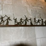
On the right inside the entrance of the chapel is a section of a column, said to be the one to which Jesus was tied when he was scourged. Along the far wall, scenes of the Way of the Cross are depicted in wrought iron.


Greek and Armenian chapels

Returning past the altar of St Mary Magdalene, turn left into a rather dark gallery, known as the Arches of the Virgin (commemorating a belief that Mary made visits to her son’s Tomb). It contains pillars and other remains from earlier constructions.

Church of the Holy Sepulchre chapels

Prison of Christ chapel in Church of the Holy Sepulchre (Seetheholyland.net)

At the far end, on the left, is a small Greek chapel called the Prison of Christ, apparently based on a belief that he was temporarily confined here before the crucifixion.

Further around the semi-circular aisle are two chapels on the left. The first is the Greek Chapel of St Longinus. It is dedicated to the Roman soldier who pierced Jesus’ side with his spear and then accepted him as the Son of God.

Further along is the Armenian Chapel of the Division of the Raiment, recalling that the Roman soldiers divided Christ’s clothes among them.

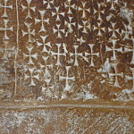
Next on the left is a stairwell, its walls inscribed with hundreds of crosses left by pilgrims in past centuries.


Two chapels are underground

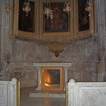
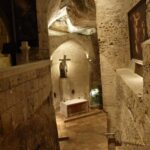
The 29 steep steps descend to the underground Armenian Chapel of St Helena. This was the crypt of the emperor Constantine’s 4th-century basilica and is therefore the oldest complete part of the entire building.

The Armenians have re-named the chapel to honour their national patron, St Gregory the Illuminator. The left-hand altar is dedicated to St Dismas (the Good Thief).

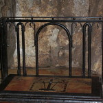
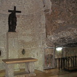
In an ancient quarry behind a wrought iron gate (open only with permission from the Armenians) is the Chapel of St Vartan and the Armenian Martyrs.

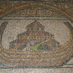
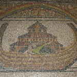
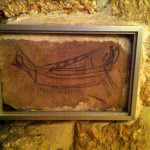
On a stone in a second-century wall is a drawing of a sailing vessel with a Latin inscription usually rendered as DOMINE IVIMUS (“Lord, we will go”). One interpretation is that it is a pilgrim’s reference to Psalm 122 (“I was glad when they said to me, “Let us go to the house of the Lord’.”

Church of the Holy Sepulchre chapels

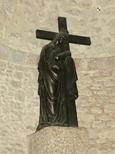
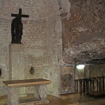
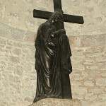
Statue of St Helena holding the Cross of Christ, in Chapel of the Finding of the Cross (Seetheholyland.net)

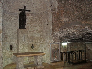
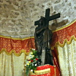
From the right of the chapel, another steep staircase of 22 steps leads to the Franciscan Chapel of the Finding of the Cross. This rough-walled area has been built within part of the ancient quarry, apparently later converted into a cistern for water storage.

Here, according to tradition, St Helena (Constantine’s mother) discovered the True Cross and other instruments of the Passion and crucifixion. A statue behind the altar shows her holding the Cross.

Remnants of 12th-century frescoes are displayed behind glass walls.

After ascending all the steps to the ground floor again, immediately on the left is the Greek Chapel of the Derision. It commemorates the mocking of Jesus by the Roman soldiers. Under the altar is a fragment of a column, said to be the one Jesus sat on when the crown of thorns was put on his head.


Rock of Calvary can be seen

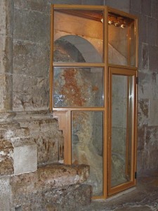
Further along, on the left, a glass screen protrudes slightly into the aisle. Through it can be seen the natural rock of Calvary.

Church of the Holy Sepulchre chapels

Rock of Calvary on display in Church of the Holy Sepulchre (Seetheholyland.net)

Next to it is a small area called the Chapel of Adam. It is directly beneath the Chapel of Calvary upstairs, and an ancient tradition suggests that Adam was buried here and that the blood of Jesus tricked down to his skull.

Here the rock of Calvary can be seen again, with a fissure running through it. Some believe the fissure was caused by the earthquake at the time Christ died. Others suggest that the rock of Calvary was left standing by quarrymen because it was cracked.

From this chapel, a door leads to the Greek Treasury, holding relics including one of the True Cross. The treasury is usually closed.


Rights of possession are jealously guarded

Under a decree called the Status Quo imposed by the Ottoman Turks in 1757, ownership of the Church of the Holy Sepulchre is shared between the Greek Orthodox, Catholics (known in the Holy Land as Latins) and Armenian Orthodox. Three minor communities, Coptic, Syriac and Ethiopian Orthodox, have rights to use certain areas. All the churches jealously guard their rights.

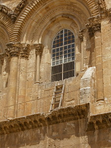
One effect of the Status Quo can be seen by looking above the main entrance on leaving the church.

Church of the Holy Sepulchre chapels

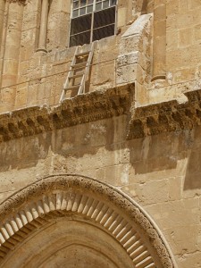
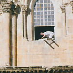
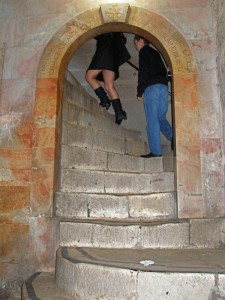
Immovable ladder over entrance to Church of the Holy Sepulchre (Seetheholyland.net)

The wooden ladder leaning against a window ledge has been there since early in the 18th century. Nobody knows why it is there, but because it was in place when the Status Quo began in 1757, it must remain there.

As one faces the main entrance, to the right is a disused stairway that was the Crusaders’ entrance to Calvary. At the top of the stairs is the Chapel of the Franks. Beneath it is the Greek Orthodox Chapel of St Mary of Egypt — a prostitute who was converted in the church courtyard in the 4th century and spent the rest of her life as a hermit.

Related article:

Church of the Holy Sepulchre

In Scripture:

The crucifixion: Matthew 27:24-56; Mark 15:16-41; Luke 23:1-49; John 19:1-37

The burial of Jesus: Matthew 27:57-66; Mark 15:42-47; Luke 23:50-56; John 19:38-42

The Resurrection: Matthew 28:1-10; Mark 16:1-8; Luke 24:1-12; John 20:1-10

Administered by: Confraternity of the Holy Sepulchre (Greek Orthodox), Franciscan Custody of the Holy Land (Catholic), Brotherhood of St James (Armenian Orthodox)

Tel.: 972-2-6267000

Opens: Apr-Sep 4am, Oct-Mar 5am. Closes: Apr-Aug 8pm, Mar and Sep 7.30pm, Oct-Feb 7pm.  Sunday morning liturgies are usually: Coptic 4am, Catholic 5.30am, Greek Orthodox 7am, Syriac Orthodox 8am; Armenian Orthodox 8.45am on alternating Sundays with a weekly procession at 4.15pm.

References:

Bar-Am, Aviva: Beyond the Walls: Churches of Jerusalem (Ahva Press, 1998)
Benelli, Carla, and Saltini, Tommaso (eds): The Holy Sepulchre: The Pilgrim’s New Guide (Franciscan Printing Press, 2011)
Freeman-Grenville, G. S. P.: The Holy Land: A Pilgrim’s Guide to Israel, Jordan and the Sinai (Continuum Publishing, 1996)
Gonen, Rivka: Biblical Holy Places: An illustrated guide (Collier Macmillan, 1987)
Inman, Nick, and McDonald, Ferdie (eds): Jerusalem & the Holy Land (Eyewitness Travel Guide, Dorling Kindersley, 2007)
Murphy-O’Connor, Jerome: The Holy Land: An Oxford Archaeological Guide from Earliest Times to 1700 (Oxford University Press, 2005)
Wareham, Norman, and Gill, Jill: Every Pilgrim’s Guide to the Holy Land (Canterbury Press, 1996)
Wright, J. Robert: “Holy Sepulchre”, Holy Land, spring 1998)

External links:

Holy Sepulchre (Custodia Terrae Sanctae)
Church of the Holy Sepulchre (Wikipedia)
Church of the Holy Sepulcher (Jerusalem Virtual Tours)
« Newer PostsOlder Posts »

Church of the Holy Sepulchre

Jerusalem

Church of the Holy Sepulchre

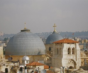
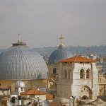
Domes and cropped bell tower of Church of the Holy Sepulchre (Seetheholyland.net)

The Church of the Holy Sepulchre in the Old City of Jerusalem covers what Christians believe is the site of the most important event in human history: The place where Jesus Christ rose from the dead.

But the pilgrim who looks for the hill of Calvary and a tomb cut out of rock in a garden nearby will be disappointed.

• At first sight, the church may bring on a sense of anticlimax. Looking across a hemmed-in square, there is the shabby façade of a dun-coloured, Romanesque basilica with grey domes and a cut-off belfry.

• Inside, there is a bewildering conglomeration of 30-plus chapels and worship spaces. These are encrusted with the devotional ornamentation of several Christian rites.

This sprawling Church of the Holy Sepulchre displays a mish-mash of architectural styles. It bears the scars of fires and earthquakes, deliberate destruction and reconstruction down the centuries. It is often gloomy and usually thronging with noisy visitors.

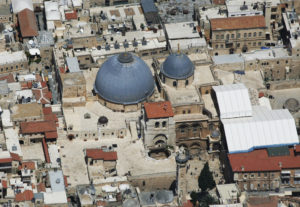
The Church of the Holy Sepulchre from above, huddled in by surrounding buildings (Ilan Arad / Wikimedia)

The Church of the Holy Sepulchre from above, huddled in by surrounding buildings (Ilan Arad / Wikimedia)

Yet it remains a living place of worship. Its ancient stones are steeped in prayer, hymns and liturgies. It bustles daily with fervent rounds of incensing and processions.

This is the pre-eminent shrine for Christians, who consider it the holiest place on earth. And it attracts pilgrims by the thousand, all drawn to pay homage to their Saviour, Jesus Christ.


Church replaced pagan temple

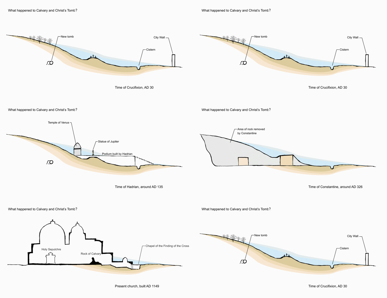
Early Christians venerated the site. Then the emperor Hadrian covered it with a pagan temple.

Church of the Holy Sepulchre

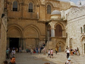
Parvis (courtyard) of Church of the Holy Sepulchre (Seetheholyland.net)

Only in AD 326 was the first church begun by the emperor Constantine I. He tore down the pagan temple and had Christ’s tomb cut away from the original hillside. Tradition says his mother, St Helena, found the cross of Christ in a cistern not far from the hill of Calvary.

Constantine’s church was burned by Persians in 614, restored, destroyed by Muslims in 1009 and partially rebuilt. Crusaders completed the reconstruction in 1149. The result is essentially the church that stands today.

Making sense of the church

Of all the Christian holy places, the Church of the Holy Sepulchre is probably the most difficult for pilgrims to come to terms with.

To help make sense of it, this article deals with the church’s major elements and its authenticity. A further article, Church of the Holy Sepulchre chapels, deals with its other devotional areas.

1. The main access to the church, on its south side, is from the Souk el-Dabbagha, a street of shops selling religious souvenirs. Visitors enter the left-hand doorway (the right one was blocked up by Muslim conquerors in the 12th century).

Church of the Holy Sepulchre

Climbing steps to Calvary (Seetheholyland.net)

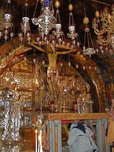
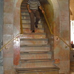
2. Instead of following tourists into the often-gloomy interior, immediately turn hard right and ascend a steep and curving flight of stairs. You are now ascending the “hill” of Calvary (from the Latin) or Golgotha (from the Aramaic), both words meaning “place of the skull”. The stairs open on to a floor that is level with the top of the rocky outcrop on which Christ was crucified. It is about 4.5 metres above the ground floor.

3. Immediately on the right is a window looking into a small worship space called the Chapel of the Franks. Here the Tenth Station of the Cross (Jesus is stripped of his garments) is located.

On the floor of Calvary are two chapels side by side, Greek Orthodox on the left, Catholic on the right. They illustrate the vast differences in liturgical decoration between Eastern and Western churches.

4. The Catholic Chapel of the Nailing to the Cross is the site of the Eleventh Station of the Cross (Jesus is nailed to the cross). On its ceiling is a 12th-century medallion of the Ascension of Jesus — the only surviving Crusader mosaic in the building.

Church of the Holy Sepulchre

Greek Orthodox Chapel of the Crucifixion (Seetheholyland.net)

5. The much more ornate Greek Chapel of the Crucifixion is the Twelfth Station (Jesus dies on the cross). Standing here, it is easy to understand a little girl’s remark, quoted by the novelist Evelyn Waugh in 1951: “I never knew Our Lord was crucified indoors.”

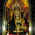
6. Between the two chapels, a Catholic altar of Our Lady of Sorrows commemorates the Thirteenth Station (Jesus is taken down from the cross).

7. A silver disc beneath the Greek altar marks the place where it is believed the cross stood. The limestone rock of Calvary may be touched through a round hole in the disc. On the right, under glass, can be seen a fissure in the rock. Some believe this was caused by the earthquake at the time Christ died. Others suggest that the rock of Calvary was left standing by quarrymen because it was cracked.

8. Another flight of steep stairs at the left rear of the Greek chapel leads back to the ground floor.

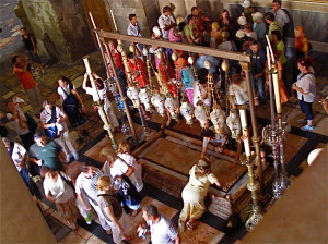
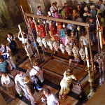
9. To the left is the Stone of Anointing, a slab of reddish stone flanked by candlesticks and overhung by a row of eight lamps.

Stone of Anointing from above (Seetheholyland.net)

Stone of Anointing from above (Seetheholyland.net)

Kneeling pilgrims kiss it with great reverence, although this is not the stone on which Christ’s body was anointed. This devotion is recorded only since the 12th century. The present stone dates from 1810.

10. On the wall behind the stone is a Greek mosaic depicting (from right to left) Christ being taken down from the cross, his body being prepared for burial, and his body being taken to the tomb.

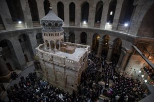
11. Continuing away from Calvary, the Rotunda of the church opens up on the right, surrounded by massive pillars and surmounted by a huge dome. Its outer walls date back to the emperor Constantine’s original basilica built in the 4th century. The dome is decorated with a starburst of tongues of light, with 12 rays representing the apostles.

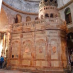
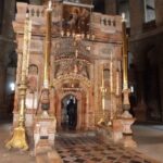
12. In the centre is a stone edicule (“little house”), its entrance flanked by rows of huge candles. This is the Tomb of Christ, the Fourteenth Station of the Cross.

This stone monument encloses the tomb (sepulchre) where it is believed Jesus Christ lay buried for three days — and where he rose from the dead. A high-tech photogrammetric survey late in the 20th century showed that the present edicule contains the remains of three previous structures, each encasing the previous one, like a set of Russian dolls.

The Edicule after restoration in 2017 (Ben Gray / ELCJHL)

The Edicule after restoration in 2017 (Ben Gray / ELCJHL)

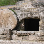
13. At busy times, Greek Orthodox priests control admission to the edicule. Inside there are two chambers. In the outer one, known as the Chapel of the Angel, stands a pedestal containing what is believed to be a piece of the rolling stone used to close the tomb.

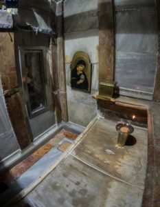
14. A very low doorway leads to the tomb chamber, lined with marble and hung with holy pictures. On the right, a marble slab covers the rock bench on which the body of Jesus lay. It is this slab which is venerated by pilgrims, who customarily place religious objects and souvenirs on it.

The slab was deliberately split by order of the Franciscan custos (guardian) of the Holy Land in 1555, lest Ottoman Turks should steal such a fine piece of marble.

An agreement between the major Christian communities at the church enabled work to begin in May 2016 to reinforce and restore the edicule. The work was undertaken by a team of scientists from the National Technical University of Athens.

Inside the restored tomb chamber, with the window exposing the rock wall of the burial cave at left (© Custodia Terrae Sanctae)

Inside the restored tomb chamber, with the window exposing the rock wall of the burial cave at left (© Custodia Terrae Sanctae)

In October 2016 the team removed the marble slab, exposing a layer of fill material covering another slab of marble with a small Crusader cross etched on it. Beneath it was the bench on which the body of Jesus lay.

When the team restored the marble cladding and resealed the burial bed, they also cut a small window into the southern interior wall of the shrine to expose one of the limestone walls of the burial cave.

The multi-million-dollar restoration was completed in March 2017. The reddish-cream marble of the edicule emerged cleaned of centuries of grime, dust and soot from candle smoke, and freed from a grid of iron girders that had held it together since 1947.

But scientists warned that even more work would be necessary to shore up the unstable foundations of the shrine and the surrounding rotunda to avoid the risk of collapse. This was to be undertaken during a two-year project to restore and conserve the pavement stones inside the church that began in March 2022.

Three denominations share ownership

Ownership of the Church of the Holy Sepulchre is shared between the Greek Orthodox, Catholics (known in the Holy Land as Latins) and Armenian Orthodox.

The Greeks (who call the basilica the Anastasis, or Church of the Resurrection) own its central worship space, known as the Katholikon or Greek choir. The Armenians own the underground Chapel of St Helena which they have renamed in honour of St Gregory the Illuminator.

Katholikon (or Greek choir), the central worship space in the Church of the Holy Sepulchre (Seetheholyland.net)

The Catholics own the Franciscan Chapel of the Apparition (which commemorates the tradition that the risen Christ first appeared to his Mother) and the deep underground Chapel of the Finding of the Cross.

Three minor Orthodox communities, Coptic, Syriac and Ethiopian, have rights to use certain areas. The Ethiopian monks live in a kind of African village on the roof, called Deir es-Sultan.

The rights of possession and use are spelt out by a decree, called the Status Quo, originally imposed by the Ottoman Turks in 1757. It even gives two Muslim families the sole right to hold the key and open and close the church — a tradition that dates back much further, to 1246.


Ladder symbolises Status Quo

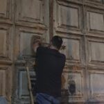
Each religious community guards its rights jealously. The often-uneasy relationship laid down by the Status Quo is typified by a wooden ladder resting on a cornice above the main entrance and leaning against a window ledge.

Chapel of the Finding of the Cross (Seetheholyland.net)

Chapel of the Finding of the Cross (Seetheholyland.net)

The ladder has been there so long that nobody knows how it got there. Various suggestions have been offered: It was left behind by a careless mason or window-cleaner; it had been used to supply food to Armenian monks locked in the church by the Turks; it had served to let the Armenians use the cornice as a balcony to get fresh air and sunshine rather than leave the church and pay an Ottoman tax to re-enter it.

The ladder appears in an engraving of the church dated 1728, and it was mentioned in the 1757 edict by Sultan Abdul Hamid I that became the basis for the Status Quo.

Immovable ladder on ledge over entrance to Church of the Holy Sepulchre (Seetheholyland.net)

It would be too much to expect that the ladder seen today has resisted the elements since early in the 18th century. In fact the original has been replaced at least once.

In 1997 the ladder suddenly disappeared for some weeks, after a Protestant prankster hid it behind an altar. When it was discovered and returned, a steel grate was installed over the lower parts of both windows above the entrance. And in 2009 the ladder mysteriously appeared against the left window for a day.

The ladder, window and cornice are all in the possession of the Armenian Orthodox. And because the ladder was on the cornice when the Status Quo began in 1757, it must remain there.


Archaeology supports authenticity

Visitors may easily be disillusioned by the church’s contrasting architectural styles, its pious ornamentation and its competing liturgies.

If these man-made elements could be removed, as biblical scholar John J. Kilgallen has written, “we would stand between two places not more than 30 yards [90 feet] apart, with dirt and rock and grass under our feet and the open air all around us. Such was the original state of this area before Jesus died and was buried here.”

Church of the Holy Sepulchre

Inside the Tomb of Christ (© Adriatikus)

But is this the place where Christ died and was buried? “Very probably, Yes,” declares biblical scholar Jerome Murphy-O’Connor in his Oxford Archaeological Guide The Holy Land. Eusebius, the first Church historian (in the 4th century), says the site was venerated by the early Christian community.

And the Israeli scholar Dan Bahat, former city archaeologist of Jerusalem, says: “We may not be absolutely certain that the site of the Holy Sepulchre Church is the site of Jesus’ burial, but we have no other site that can lay a claim nearly as weighty, and we really have no reason to reject the authenticity of the site.”

One major objection raised is that the Church of the Holy Sepulchre is inside the city walls, while the Gospels say the crucifixion took place outside. Archaeologists have confirmed that the site of the church was outside the city until about 10 years after Christ’s death, when a new wall was built.

Some favour a competing site, the Garden Tomb. Though it offers a more serene environment, the tombs in its area predate the time of Christ by several centuries.

Further article:

Church of the Holy Sepulchre chapels, dealing with the other devotional areas.


In Scripture:

The crucifixion: Matthew 27:27-56; Mark 15:16-41; Luke 23:26-49; John 19:16-37

The burial of Jesus: Matthew 27:57-66; Mark 15:42-47; Luke 23:50-56; John 19:38-42

The Resurrection: Matthew 28:1-10; Mark 16:1-8; Luke 24:1-12; John 20:1-10

Administered by: Confraternity of the Holy Sepulchre (Greek Orthodox), Franciscan Custody of the Holy Land (Catholic), Brotherhood of St James (Armenian Orthodox)

Tel.: 972-2-6267000

Opens: Apr-Sep 4am, Oct-Mar 5am. Closes: Apr-Aug 8pm, Mar and Sep 7.30pm, Oct-Feb 7pm.  Sunday morning liturgies are usually: Coptic 4am, Catholic 5.30am, Greek Orthodox 7am, Syriac Orthodox 8am; Armenian Orthodox 8.45am on alternating Sundays with a weekly procession at 4.15pm.


References:
Bahat, Dan: “Does the Holy Sepulchre Church Mark the Burial of Jesus?” (Biblical Archaeology Review, May-June 1986)
Bar-Am, Aviva: Beyond the Walls: Churches of Jerusalem (Ahva Press, 1998)
Benelli, Carla, and Saltini, Tommaso (eds): The Holy Sepulchre: The Pilgrim’s New Guide (Franciscan Printing Press, 2011).
Charlesworth, James H.: The Millennium Guide for Pilgrims to the Holy Land (BIBAL Press, 2000)
Cohen, Raymond: Saving the Holy Sepulchre: How Rival Christians Came Together to Rescue their Holiest Shrine (Oxford University Press, 2008)
Freeman-Grenville, G. S. P.: The Holy Land: A Pilgrim’s Guide to Israel, Jordan and the Sinai (Continuum Publishing, 1996)
Gonen, Rivka: Biblical Holy Places: An illustrated guide (Collier Macmillan, 1987)
Hadid, Diaa: “Risk of Collapse at Jesus’ Tomb Unites Rival Christians” (New York Times, April 6, 2016)
Herman, Danny: “Who Moved the Ladder?” (Biblical Archaeology Review, January/February 2010).
Kilgallen, John J.: A New Testament Guide to the Holy Land (Loyola Press, 1998)
Mackowski, Richard M.: Jerusalem: City of Jesus (William B. Eerdmans, 1980)
Murphy-O’Connor, Jerome: The Holy Land: An Oxford Archaeological Guide from Earliest Times to 1700 (Oxford University Press, 2005)
Notley, R. Steven: Jerusalem: City of the Great King (Carta Jerusalem, 2015)
Powers, Tom: “The Church of the Holy Sepulchre: Some perspectives from history, geography, architecture, archaeology and the New Testament” (Artifax, Autumn 2004-Spring 2005)
Prag, Kay: Jerusalem: Blue Guide (A. & C. Black, 1989)
Simmermacher, Günther: The Holy Land Trek: A Pilgrim’s Guide (Southern Cross Books, 2012).
Wareham, Norman, and Gill, Jill: Every Pilgrim’s Guide to the Holy Land (Canterbury Press, 1996)
Waugh, Evelyn: “The Plight of the Holy Places” (Life, December 24, 1951.
Wright, J. Robert: “Holy Sepulchre” (Holy Land, spring 1998)

External links:

Holy Sepulchre (Custodia Terrae Sanctae)
Church of the Holy Sepulchre (Wikipedia)
The Church and the Ladder: Frozen in Time (James E. Lancaster)
Unsealing of Christ’s reputed tomb turns up new revelations (National Geographic)
Jesus’ tomb reopens in Jerusalem after multi-million dollar restoration (Haaretz)
Tomb of Christ at Risk of ‘Catastrophic’ Collapse (National Geographic)
« Newer PostsOlder Posts »

Via Dolorosa

Jerusalem

Via Dolorosa

First Station: Pilgrims carry a cross through the courtyard of the Al-Omariyyeh College (© Custodia Terrae Sanctae)

Chapel of the Flagellation

Chapel of the Condemnation

Ecce Homo Arch


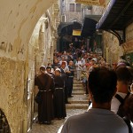
Every Friday afternoon hundreds of Christians join in a procession through the Old City of Jerusalem, stopping at 14 Stations of the Cross as they identify with the suffering of Jesus on his way to crucifixion.

Their route is called the Via Dolorosa (Way of Sorrows). This is also the name of the principal street they follow, a narrow marketplace abustle with traders and shoppers, most likely similar to the scene on the first Good Friday.

It is unlikely that Jesus followed this route on his way to Calvary. Today’s Via Dolorosa originated in pious tradition rather than in certain fact, but it is hallowed by the footsteps of the faithful over centuries.


Franciscans lead procession
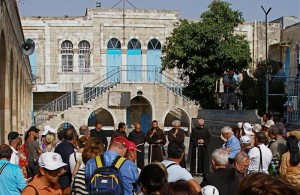
Via Dolorosa

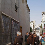
First Station: Franciscan friars begin the Friday observance in the courtyard of the Al-Omariyyeh College (Seetheholyland.net)

The Friday procession is led by Franciscan friars, custodians of most of the holy places since the 13th century.

It starts at 4pm — 3pm in winter, from late October till late March — at an Islamic college, Umariyya School, just inside St Stephen’s or Lions’ Gate. Pilgrims wind their way westward to the Church of the Holy Sepulchre, where the last five Stations are located.

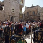
Each procession is accompanied by escorts called kawas, in Ottoman uniforms of red fez, gold-embroidered waistcoat and baggy blue trousers, who signify their authority by banging silver-topped staves on the ground.

Many other pilgrims, individually or in groups with guides, follow the same 500-metre route during the week.
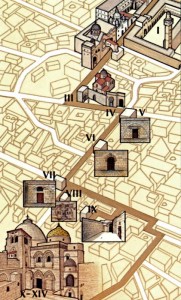
Via Dolorosa

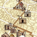
Route of the Via Dolorosa (© Custodia Terrae Sanctae)

For those walking the Via Dolorosa on their own, the route is not easy to follow.

A simple map is available from the Christian Information Centre, Omar Ibn el-Khattab Square, Jaffa Gate (closed on Sundays, Christian holidays and Saturday afternoons). The PlanetWare travel guide also has a map.


Number of Stations has varied

While scholars disagree on the path Jesus took on Good Friday, processions in the 4th and 5th centuries from the Mount of Olives to Calvary followed more or less along the route taken by modern pilgrims (but there were no stops for Stations).

The practice of following the Stations of the Cross appears to have developed in Europe among Christians who could not travel to the Holy Land. The number of Stations varied from 7 to 18 or more.

Today’s Via Dolorosa route was established in the 18th century, with the present 14 Stations, but some of the Stations were given their present location only in the 19th century.
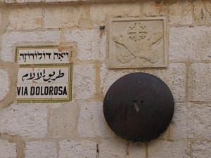
Via Dolorosa

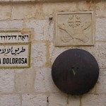
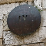
Bronze discs mark Stations on the Via Dolorosa; the crossed arms are a Franciscan symbol (Seetheholyland.net)

Nine of the 14 stations are based on Gospel references. The other five — Jesus’ three falls, his meeting with his Mother, and Veronica wiping his face — are traditional.


Place of judgement unknown

The chief difficulty in determining Jesus’ path to Calvary is that nobody knows the site of Pontius Pilate’s Praetorium, where Jesus was condemned to death and given the crossbeam of his cross to carry through the streets.

There are three possible locations:

Herod the Great’s Palace or Citadel, which dominated the Upper City. The remains of the Citadel complex, with its Tower of David (erected long after King David’s time), are just inside the present Jaffa Gate. This is the most likely location.
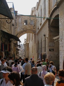
Via Dolorosa

Second Station: Ecce Homo Arch over Via Dolorosa, with Sisters of Zion convent at right (Seetheholyland.net)

• The Antonia Fortress, a vast military garrison built by Herod the Great north of the Temple compound and with a commanding view of the Temple environs. The Umariyya School, now the location of the first Station of the Cross, is believed to stand on part of its site.

• The Palace of the Hasmoneans, built before Herod’s time to house the rulers of Judea. It was probably located midway between Herod’s Palace and the Temple, in what is today the Jewish Quarter.

In the immediate area of the Antonia Fortress is the Ecce Homo Arch, reaching across the Via Dolorosa. It is named after the famous phrase (“Behold the Man” in Latin) spoken by Pilate when he showed the scourged Jesus to the crowd (John 19:5). But the arch was built after Jesus stood before Pilate.

Adjacent to the arch is the Ecce Homo Convent of the Sisters of Our Lady of Zion (the entrance is near the corner of the Via Dolorosa and a narrow alley called Adabat el-Rahbat, or The Nuns Ascent).
Via Dolorosa

Second Station: Roman soldiers’ game in Lithostrotos pavement under Zion Sisters convent (© Custodia Terrae Sanctae)

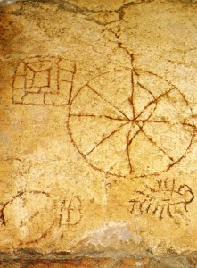
Underneath the convent, pilgrims can visit stone pavings which were once claimed to be the Stone Pavement (Lithostrotos) where Pilate had his judgement seat (John 19:13).

Markings in the paving stones, indicating a dice game known as the King’s Game, suggested this was where Jesus was mocked by the soldiers (John 19:2-3). Yet this pavement is also from a later date.

Chapels worth visiting

Several of the chapels at the various Stations of the Cross are not often open to the public. Two at the beginning of the Via Dolorosa are open daily (8-12am, 2-5pm) and are worth visiting before starting the Way of the Cross.

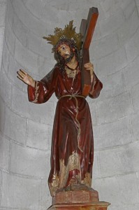
Across the street from Umariyya School is a Franciscan compound containing the Chapel of the Flagellation and the Chapel of the Condemnation and Imposition of the Cross.
Via Dolorosa

Second Station: Jesus takes up his cross, in Chapel of the Condemnation (Tom Callinan/Seetheholyland.net)

The Chapel of the Flagellation is notable for its stained-glass windows behind the altar and on either side of the sanctuary. They show Pilate washing his hands; Jesus being scourged; and Barabbas expressing joy at his release. On the ceiling above the altar, a mosaic on a golden background depicts the crown of thorns pierced by stars.

The Flagellation Museum, displaying archaeological artifacts from several Holy Land sites, including Nazareth, Capernaum and the Mount of Olives, is open daily (except Sunday and Monday), 9am-1pm and 2-4pm.

The Chapel of the Condemnation and Imposition of the Cross is topped by five white domes. Artwork includes papier-mâché figures enacting some of the events of Jesus’ Passion.

Paving stones at the back of the chapel are part of the pavement that extends under the Ecce Homo Convent.
Via Dolorosa

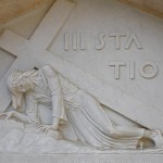
Third Station: Relief depicting Jesus’ first fall (Seetheholyland.net)

Opposite the chapel entrance is a model of Jerusalem in the first century AD, showing how the sites of Calvary and the Holy Sepulchre were outside the city walls.


The 14 Stations

Numbering of the Stations of the Cross along the Via Dolorosa traditionally uses Roman numerals, and in 2019 bronze sculptures were added to depict what is commemorated at each station:

I: Jesus is condemned to death
Via Dolorosa

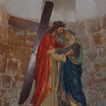
Fourth Station: Sculpture depicting Jesus meeting his Mother (Seetheholyland.net)

About 300 metres west of St Stephen’s or Lions’ Gate, steps lead up to the courtyard of Umariyya School (open Monday-Thursday and Saturday, 2.30-6pm, Friday 2.30-4pm; entry with caretaker’s permission).

Here the First Station is commemorated. The southern end of the courtyard offers a view overlooking the Temple Mount.

II: Jesus carries his cross

Across the street, near where an arch stretches over the Via Dolorosa, the Second Station is marked by the words “II Statio” on the wall of the Franciscan Friary.

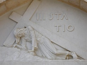
III: Jesus falls the first time

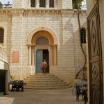
Down the Via Dolorosa, under the Ecce Homo Arch and about 100 metres along, a sharp left turn into Al-Wad Road brings pilgrims to a small chapel on the left, belonging to the Armenian Catholic Patriarchate.
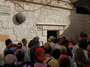
Via Dolorosa

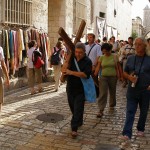
Fifth Station: Pilgrims on the Way of the Cross (Seetheholyland.net)

Above the entrance, a stone relief of Jesus falling with his cross marks the Third Station. Inside, a similar image is watched by shocked angels.

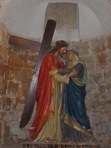
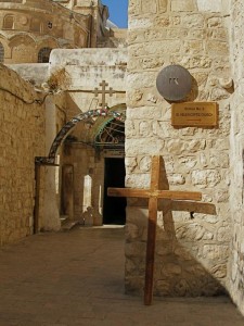
IV: Jesus meets his Mother

The Fourth Station is now commemorated adjacent to the Third Station. Until 2008 this Station was commemorated a further 25 metres along Al-Wad Road.

The stone relief marking the Station is over the doorway to the courtyard of an Armenian Catholic church. In the crypt are a strikingly attractive adoration chapel and part of a mosaic floor from a 5th-century church. In the centre of the mosaic is depicted a pair of sandals, said to represent the spot where the suffering Mary was standing.
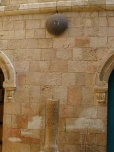
Via Dolorosa

Sixth Station: Column imbedded in wall recalls tradition that Veronica wiped Jesus’ face here (Seetheholyland.net)

V: Simon of Cyrene helps Jesus carry his cross

About 25 metres further along Al-Wad Road, the Via Dolorosa turns right. At the corner, the lintel over a doorway bears a Latin inscription marking the site where Simon, a visitor from present-day Libya, became involved in Jesus’ Passion.

The Franciscan chapel here, dedicated to Simon the Cyrenian, is on the site of the Franciscans’ first house in Jerusalem, in 1229.

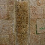
VI: Veronica wipes the face of Jesus

The Via Dolorosa now becomes a narrow, stepped street as it wends its way uphill. About 100 metres on the left, a wooden door with studded metal bands indicates the Greek Catholic (Melkite) Church of St Veronica.

According to tradition, the face of Jesus was imprinted on the cloth she used to wipe it. A cloth described as Veronica’s veil is reported to have been kept in St Peter’s Basilica in Rome since the 8th century.

VII: Jesus falls the second time
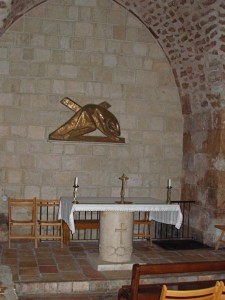
Via Dolorosa

Seventh Station: Relief depicting Jesus’ second fall, in one of the chapels at the Station (Seetheholyland.net)

About 75 metres further uphill, at the junction of the Via Dolorosa with Souq Khan al-Zeit, two Franciscan chapels, one above the other, mark the Seventh Station.

Inside the lower chapel is a large stone column, part of the colonnaded Cardo Maximus, the main street of Byzantine Jerusalem, which ran from north to south.

The position of this Station marks the western boundary of Jerusalem in Jesus’ time. It is believed he left the city here, through the Garden Gate, on his way to Calvary.

VIII: Jesus consoles the women of Jerusalem

Across Souq Khan al-Zeit and about 20 metres up a narrower street, the Eighth Station is opposite the Station VIII Souvenir Bazaar.

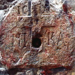
On the wall of a Greek Orthodox monastery, beneath the number marker is a carved stone set at eye level. It is distinguished by a Latin cross flanked by the Greek letters IC XC NI KA (meaning “Jesus Christ conquers”).
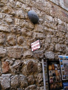
Via Dolorosa

Eighth Station: Stone in wall, carved with Latin cross (Seetheholyland.net)

IX: Jesus falls the third time

Now it is necessary to retrace one’s steps back towards the Seventh Station, and turn right along Souq Khan al-Zeit.

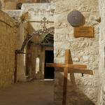
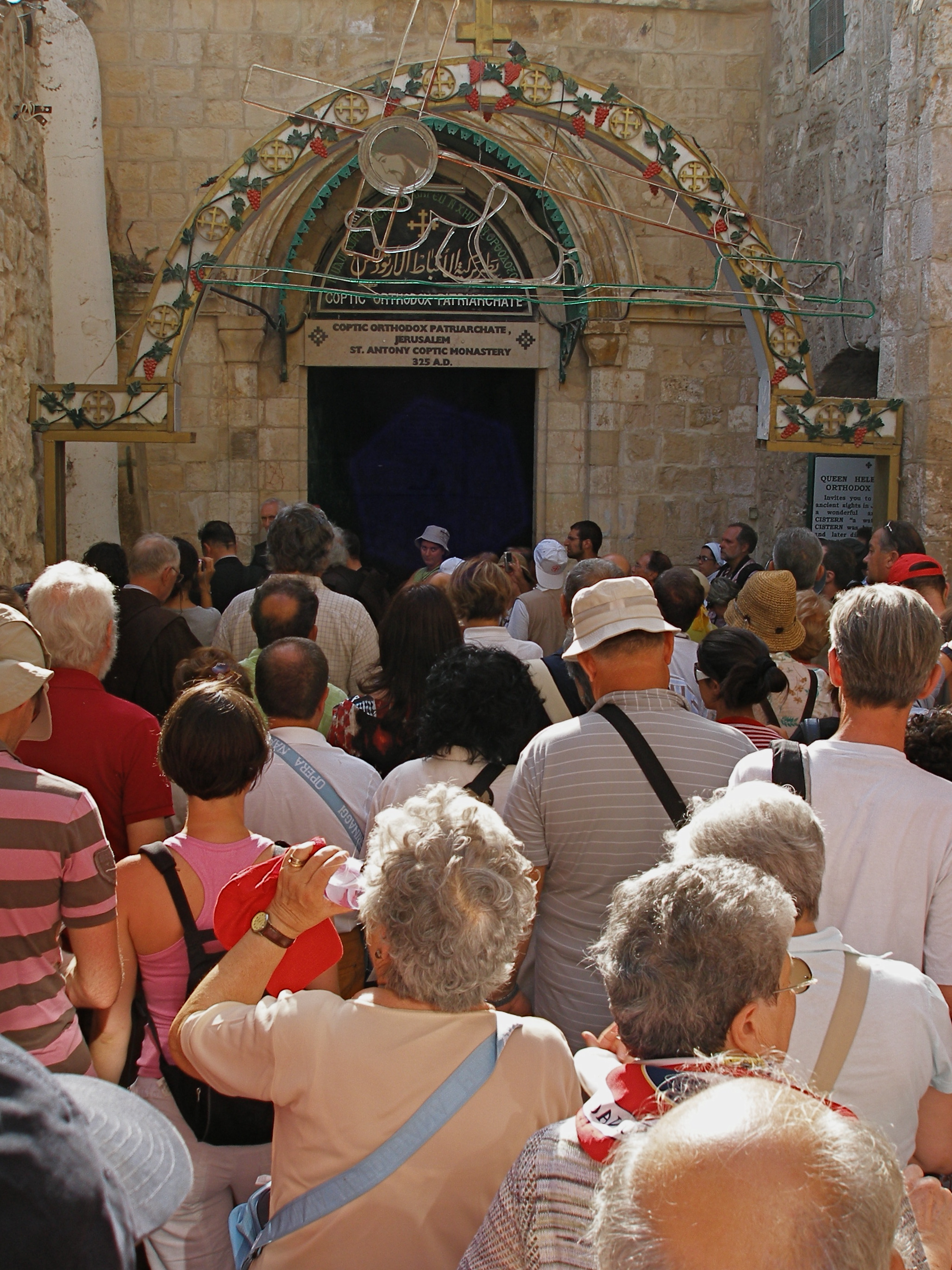
Less than 100 metres on the right is a flight of 28 wide stone steps. At the top, a left turn along a winding lane for about 80 metres leads to the Coptic Orthodox Patriarchate, where the shaft of a Roman pillar to the left of the entrance marks Jesus’ third fall. Nearby is the Coptic Chapel of St Helen.

To the left of the pillar, three steps lead to a terrace that is the roof of the Chapel of St Helena in the Church of the Holy Sepulchre. Here, in a cluster of primitive cells, live a community of Ethiopian Orthodox monks.

X: Jesus is stripped of his garments

The last five Stations of the Cross are situated inside the Church of the Holy Sepulchre.
Via Dolorosa

Ninth Station: Roman pillar in far corner marks Jesus’ third fall (Seetheholyland.net)

If the door to the roof of the church is open, a short cut is possible.

On the terrace, the second small door on the right leads into the Ethiopians’ upper chapel. Steps at the back descend to their lower chapel, where a door gives access to the courtyard of the Holy Sepulchre basilica.

The Friday procession, however, returns along the winding lane and stone steps to Souq Khan al-Zeit, turning right after about 40 metres into Souq al-Dabbagha.

After about 80 metres, bearing to the right, a small archway with the words “Holy Sepulchre” leads into the church courtyard.

To the right inside the main door of the church, 19 steep and curving steps lead up to the chapels constructed above the rock of Calvary.

The five Stations inside the church are not specifically marked.
Via Dolorosa

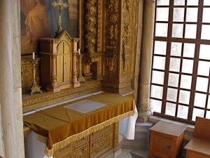
Tenth Station: Interior of Chapel of the Franks, where the Tenth Station is located (Seetheholyland.net)

After ascending the steps inside the door, immediately on the right is a window looking into a small worship space called the Chapel of the Franks (a name traditionally given to the Franciscans). Here, in what was formerly an external entrance to Calvary, the Tenth Station is located.

XI: Jesus is nailed to the cross

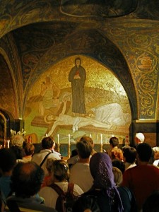
The Catholic Chapel of the Nailing to the Cross, in the right nave on Calvary, is the site of the Eleventh Station.

On its ceiling is a 12th-century medallion of the Ascension of Jesus — the only surviving Crusader mosaic in the church.
Via Dolorosa

Eleventh Station: Catholic chapel on Calvary floor commemorates the nailing of Jesus to the cross (Seetheholyland.net)

XII: Jesus dies on the cross

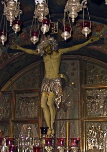
The much more ornate Greek Orthodox Chapel of the Crucifixion, in the left nave of Calvary, is the Twelfth Station.

A silver disc beneath the altar marks the place where it is believed the cross of Christ stood. The limestone rock of Calvary may be touched through a round hole in the disc.

XIII: Jesus is taken down from the cross

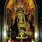
Between the Catholic and Greek chapels, a Catholic altar of Our Lady of Sorrows, depicting Mary with a sword piercing her heart, commemorates the Thirteenth Station.

XIV: Jesus is laid in the tomb
Via Dolorosa

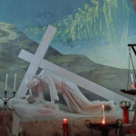
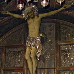
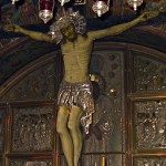
Twelfth Station: Close-up of figure of Christ in Chapel of the Crucifixion (Picturesfree.org)

Another flight of steep stairs at the left rear of the Greek chapel leads back to the ground floor.

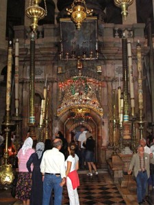
Downstairs and to the left, under the centre of the vast dome of the church, is a stone monument called an edicule (“little house”), its entrance flanked by rows of huge candles.

This is the Tomb of Christ, the Fourteenth Station of the Cross.

This stone monument encloses the tomb (sepulchre) where it is believed Jesus lay buried for three days — and where he rose from the dead on Easter Sunday morning.


Related articles:

Church of the Holy Sepulchre

Church of the Holy Sepulchre Chapels
 

Via Dolorosa

Fourteenth Station: Edicule over the Tomb of Jesus (© Custodia Terrae Sanctae)

In Scripture:

The crucifixion: Matthew 27:24-61; Mark 15:15-47; Luke 23:24-56; John 18:13—19:42
Via Dolorosa

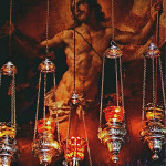
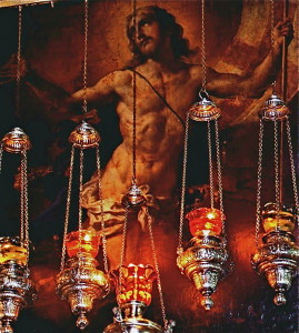
Resurrected Christ behind ornate lamps above the door of the edicule (© Custodia Terrae Sanctae)

The empty tomb: Matthew 28:1-10; Mark 16:1-8; Luke: 24:1-12; John 20:1-10

Administered by: Franciscan Custody of the Holy Land

Tel.: 972-2-6272692


References

Bar-Am, Aviva: Beyond the Walls: Churches of Jerusalem (Ahva Press, 1998)
Beitzel, Barry J.: Biblica, The Bible Atlas: A Social and Historical Journey Through the Lands of the Bible (Global Book Publishing, 2007)
Brownrigg, Ronald: Come, See the Place: A Pilgrim Guide to the Holy Land (Hodder and Stoughton, 1985)
Freeman-Grenville, G. S. P.: The Holy Land: A Pilgrim’s Guide to Israel, Jordan and the Sinai (Continuum Publishing, 1996)
Gonen, Rivka: Biblical Holy Places: An illustrated guide (Collier Macmillan, 1987)
Hibbs, Jon: “Jerusalem: Pilgrims and Playboys”, The Telegraph, April 3, 1999
Jacobs, Daniel: Jerusalem: The Mini Rough Guide (Rough Guides, 1999)
Mackowski, Richard M.: Jerusalem: City of Jesus (William B. Eerdmans, 1980)
Murphy-O’Connor, Jerome: Keys to Jerusalem (Oxford University Press, 2012)
Murphy-O’Connor, Jerome: The Holy Land: An Oxford Archaeological Guide from Earliest Times to 1700 (Oxford University Press, 2005)
Pixner, Bargil: With Jesus in Jerusalem – his First and Last Days in Judea (Corazin Publishing, 1996)
Walker, Peter: In the Steps of Jesus (Zondervan, 2006)
Zohar, Gil: “X Marks the Spot”, Associated Christian Press Bulletin, January-February 2009

External links

Way of the Cross (Catholic Encyclopedia)
Via Dolorosa: Way of the Cross (iOS app, World Evangelical Alliance)
Flagellation (Custodia Terrae Sanctae)


« Newer PostsOlder Posts »

Emmaus

Israel/West Bank

Nicopolis (Amwas, Imwas, Emmaus)           Map: 31°50’21.48”N, 34°59’22.05”E

Abu Ghosh                                                Map: 31°48’26.6”N, 35°6’28.9”E

El-Qubeibeh (El-Kubeibeh)                          Map: 31°50’23.76”N, 35°08’12.66”E

Colonia (Kulonieh, Moza, Motza, Ammaous)  Map: 31°47’38.11N, 35°10’6.45”E


The village of Emmaus was the setting for one of the most touching of Christ’s post-Resurrection appearances.

Unfortunately for pilgrims drawn by the account in Luke’s Gospel, the identity of Emmaus became lost early in the Christian era. Only in the 21st century could scholars reach a consensus favouring a location near Moza (or Motza), on the western edge of Jerusalem, where there is no commemorative site to visit.

Emmaus

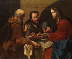
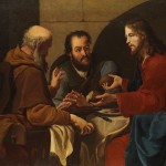
“Supper at Emmaus”, by an anonymous 17th century Italian painter (Wikimedia)

The Emmaus story is well-known: Two disciples downcast by the death of Jesus, and confused by reports that his body is missing, are walking from Jerusalem to Emmaus. They encounter a stranger who listens to their concerns, then gives them a Scripture lesson that makes their “hearts burn within them”.

Finally, as they share the evening meal, he breaks bread and they recognise him. By then the risen Christ has disappeared from their sight, and they immediately hurry back to Jerusalem. (Luke 24:13-35)

Out of several locations for Emmaus proposed over the centuries, expert opinion is focusing on Colonia (or Kulonieh), near the modern Jewish neighbourhood of Moza. Excavations instigated by the New Testament scholar Carsten Peter Thiede at the location from 2001 to 2004 confirmed the existence of an upper-class, 1st-century Jewish village which was called Emmaus.

Disciples may have been father and son

Luke’s Gospel says one of the disciples was named Cleophas. An ancient Christian tradition says he was the brother of St Joseph, the spouse of the Virgin Mary, and that he was later stoned to death outside his own house for declaring that his nephew Jesus was the Messiah foretold by the prophets.

It is believed that the “Mary of Cleophas” who stood by the cross with Jesus’ mother was the wife of the Emmaus disciple.

The same tradition says the other unnamed disciple was the youngest son of Cleophas, called Simeon — who later served for 43 years as head of the Judaeo-Christian Church in Palestine and was martyred at the age of 120.

Several other candidates for the companion of Cleophas have been suggested, including his wife Mary.

Several possible sites suggested

Emmaus

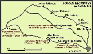
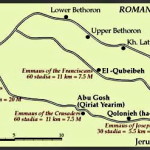
Roads to four possible locations of Emmaus (© Custodia Terrae Sanctae)

Positively locating the village of Emmaus has been made more difficult by conflicting distances from Jerusalem given in different texts of Luke’s Gospel.

Most texts (including the earliest) give the distance as 60 stadia, but some give it as 160 stadia. A Roman stadion (the plural is stadia) equals 185 metres.

Sixty stadia would be about 11 kilometres (just under 7 miles) and 160 stadia would be 29.5 kilometres (just over 18 miles).

Several possible sites have been proposed over the centuries. The four most seriously considered are:

Nicopolis (also known as Emmaus, Amwas and Imwas), near Latrun, at the end of the Ayalon Valley, around 160 stadia (30km) from Jerusalem.

Emmaus

Emmaus/Nicopolis: Cloister of Community of Beatitudes monastery (© Community of the Beatitudes)

Christians in the 4th century considered this the site of Luke’s Emmaus. St Jerome in one of his letters even implied it had a church built in the house of Cleophas. The tradition was so strong that it may have resulted in scribes “correcting” the Gospel text to read 160 rather than 60 stadia. Nevertheless, some of the most ancient manuscripts, such as the Codex Sinaiticus, have 160 stadia.

Around 220, following a delegation led by the prefect of Emmaus, Sextus Iulius Africanus (a prominent Christian), emperor Elagabalus gave Emmaus the status of a city and changed its name to Nicopolis.

The town was wiped out by plague in 639 but, re-established, became the last station of the Crusaders on their way to Jerusalem in 1099. By then the identification with Luke’s Gospel had largely been lost.

In modern times Amwas/Nicopolis was again accepted as Emmaus by 19th-century biblical scholar Edward Robinson. The identification was augmented by revelations received by Blessed Mariam of Jesus Crucified, a nun of the Carmelite monastery of Bethlehem. Advocates of Nicopolis raise the possibility that the disciples arrived back at Jerusalem the day after encountering Christ.

Emmaus

Emmaus/Nicopolis: Ruins of Byzantine church restored by Crusaders (© Israel Ministry of Tourism)

The Arab village of Amwas was levelled by Israel following the Six-Day War in 1967. Its ruins are in Ayalon (or Canada) Park, 2km north of Latrun Junction. North of the Cistercian monastery at Latrun are ruins of a large Byzantine church with mosaic floors, within which was built a smaller Crusader church.

Factors against Nicopolis: 1) The distance is much greater than the 60 stadia in most of the earliest Gospel texts. 2) It would have been very difficult for the disciples to walk here from Jerusalem and make the uphill return the same evening before the city gates were shut. 3) The existence of this Emmaus was well-known, so Luke would not have needed to identify it by distance.

Administration: Community of the Beatitudes

Tel.: 972-8-925-69-40

Emmaus

Emmaus/Abu Ghosh: Benedictine church built by Crusaders (Berthold Werner)

Open: Mon-Sat 8.30-noon, 2.30-5.30pm (5pm Oct-Mar)

Abu Ghosh, near Kiryat Yearim (or Kiryat el-Enab), just over 60 stadia (11km) west of Jerusalem on the main road to Joppa.

With the Amwas tradition lost, the Crusaders settled on Kiryat el-Enab as Emmaus. They built a church there in 1140 and called the place Castellum Emmaus.

After the Crusaders were defeated 47 years later, Muslims used the church as stables.

This town was previously known as the resting place of the Ark of the Covenant for 20 years between being retrieved from the Philistines and being taken to Jerusalem by King David around 1000 BC.

Early in the 19th century it was renamed Abu Ghosh after a family of brigands who controlled it and exacted tribute from travellers.

The Crusader church, now restored as the Church of the Resurrection, remains one of the finest examples of Crusader architecture. Its tranquil setting adjoins a Benedictine monastery. In the crypt is a spring used by the Roman Tenth Legion when it camped here after capturing Jerusalem in AD 70.

Emmaus

Emmaus/Abu Ghosh: Faded frescoes in Crusader church (© Israel Ministry of Tourism)

On the hill west of the village towers a huge statue of the Madonna and Child surmounting the Church of Our Lady of the Ark of the Covenant. The hill affords an impressive view of the Judean mountains to the east and the coastal plain to the west.

Factors against Abu Ghosh: 1) Kiryat Yearim was not called Emmaus in the 1st century. 2) It was not identified with Luke’s Emmaus until the 12th century.

Administration:

Church of the Resurrection: Benedictines

Tel.: 972-2-5342798

Open: 8.30-11.30am, 2.30-5.30pm (closed on Sundays and Christian feast days, and from Good Friday to Easter Sunday)

Church of Our Lady of the Ark of the Covenant: Sisters of St Joseph of the Apparition

Tel.: 972-2-5342818

Open: 8.30-11.30am, 2.30-5pm (on Sundays phone before visiting).

El-Qubeibeh (or El-Kubeibeh), on the Roman road to Lydda, just over 60 (11km) stadia northwest of Jerusalem.

Emmaus

Emmaus/El-Qubeibeh: Church of St Cleophas (© Custodia Terrae Sanctae)

With the Crusaders expelled from the Holy Land, Christians in the following centuries were forbidden to use the main highway from the coastal plain to Jerusalem, denying them access to Abu Ghosh.

El-Qubeibeh, which had been part of the agricultural domain of the Church of the Holy Sepulchre, was first suggested as St Luke’s Emmaus in 1280. The village was on a Roman road and in 1099 the Crusaders discovered a Roman fortress there, which became known as Castellum Emmaus.

The site was adopted in 1335 by the Franciscans, who began an annual pilgrimage there. Excavation in the 20th century found evidence of occupation in Roman times.

The Franciscans built a church there in 1902, following the lines of the Crusader church. During the Second World War the British used their monastery to inter German and Italian residents of Palestine (including Franciscans).

Emmaus

Roman road at El-Qubeibeh (© vizAviz)

On the façade of the church is a ceramic depiction of Christ and the two disciples. Inside, under glass, are the remains of what is suggested to be the foundations of the house of Cleophas. Near the church a section of Roman road has been excavated.

El-Qubeibeh is the only Emmaus candidate in Palestine, and checkpoints make access more difficult. The elevated site offers a fine outlook over the hill country towards the Mediterranean Sea.

Factors against El-Qubeibeh: 1) The village was not called Emmaus in the 1st century. 2) No Jewish objects have been found there. 3) The village was not identified with Luke’s Gospel until late in the 13th century.

Administration: Franciscan Custody of the Holy Land

Emmaus

Emmaus/El-Qubeibeh: Celebrating feast day of St Cleophas (© Custodia Terrae Sanctae)

Tel.: 050-5200417

Open: 8am-noon, 2-6pm (5pm Oct-Mar)

Colonia (also called Kulonieh, Emmaus or Ammaous), just over 30 stadia (6km) west of Jerusalem, on the road to Jaffa.

The site now favoured by modern scholars as the most likely Emmaus is just off the highway from Jerusalem to Tel Aviv and adjacent to the modern suburb of Moza.

Ancient Moza (or Mozah) was mentioned as a village of the tribe of Benjamin (Joshua 18:26). In the days of the Temple, according to the Talmud, Moza was the place where Jews collected willow branches for the Feast of Tabernacles.

Emmaus

Emmaus/Colonia: Section of Roman road from Jerusalem to Moza (© BiblePlaces.com)

After the Romans destroyed Jerusalem in AD 70, the emperor Vespasian established a colony of 800 army veterans there. This is recorded by the historian Josephus in The Jewish War. He calls the place “Ammaous”, and overestimates its location as “distant from Jerusalem threescore stadia”. The town subsequently became known as Colonia, after the veterans’ colony.

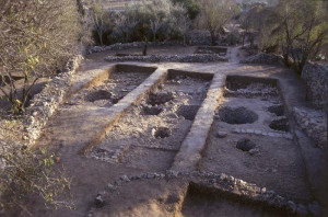
In modern times, a Palestinian village named Qalunya was destroyed by Jewish forces in 1948. Ruins and a few isolated houses remain. Excavations have revealed evidence of an upper-class, first-century Jewish village.

This Emmaus has no firm Christian tradition linking it to Luke’s Gospel, but it was within easy walking distance of Jerusalem and was known to pilgrims in the 11th and 13th centuries. There is no commemorative site.

Emmaus

Excavations at Moza (Z. Greenhut & A. De Groot excavation, © Israel Antiquities Authority)

Its supporters suggest that Luke’s 60 stadia could refer to the return distance. But there is another possibility. Josephus published The Jewish War in AD 77 or 78. Many scholars believe Luke wrote his Gospel between AD 80 and 85. Could Luke have mistakenly copied the “threescore stadia” from Josephus?

Factors against Colonia: 1) There is no certain link between the Ammaous of Josephus and the Emmaus of Luke. 2) There is no firm Christian tradition. 3) A question mark remains over the distance.

A lesson from elusive Emmaus?

The inability to identify the site of Emmaus with certainty, despite Luke’s richly detailed narrative, may leave devotees as downcast as the two disciples on the road.

They may be consoled by two compensating factors:

Emmaus

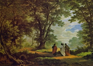
“The Walk to Emmaus”, by Gemälde von Robert Zünd (Wikimedia)

• The commemorative “Emmaus” sites at Nicopolis/Amwas, Abu Ghosh and El-Qubeibeh, even if not authentic, are all attractive places to reflect on the message of the Gospel story.

• Perhaps the elusive nature of Emmaus offers its own lesson — that what happened on that day is more important than where it happened, and that encounters with the risen Christ are not confined to one time or place.


In Scripture: The road to Emmaus (Luke 24:13-35)


References

Brownrigg, Ronald: Come, See the Place: A Pilgrim Guide to the Holy Land (Hodder and Stoughton, 1985)
Charlesworth, James H.: The Millennium Guide for Pilgrims to the Holy Land (BIBAL Press, 2000)
De Sandoli, Sabino: Emmaus-el Qubeibe (Franciscan Printing Press, 1980)
Freeman-Grenville, G. S. P.: The Holy Land: A Pilgrim’s Guide to Israel, Jordan and the Sinai (Continuum Publishing, 1996)
Gonen, Rivka: Biblical Holy Places: An illustrated guide (Collier Macmillan, 1987)
Josephus, Flavius: The Jewish War, trans. William Whiston (Kregel, Baker, 1960)
Laney, J. Carl: “The Identification of Emmaus”, from Selective Geographical Problems in the Life of Christ, doctoral dissertation (Dallas Theological Seminary, 1977)
Metzger, Bruce M., and Coogan, Michael D.: The Oxford Companion to the Bible (Oxford University Press, 1993)
Murphy-O’Connor, Jerome: The Holy Land: An Oxford Archaeological Guide from Earliest Times to 1700 (Oxford University Press, 2005)
Pierri, Rosario: “The Emmaus Enigma” (Holy Land Review, spring 2010)
Thiede, Carsten Peter: The Emmaus Mystery: Discovering Evidence for the Risen Christ (Continuum International, 2006)
Walker, Peter: In the Steps of Jesus (Zondervan, 2006)
Wareham, Norman, and Gill, Jill: Every Pilgrim’s Guide to the Holy Land (Canterbury Press, 1996)


External links

Emmaus (BibleAtlas)
The Identification of Emmaus (J. Carl Laney)
Emmaus (Catholic Encyclopedia)
Emmaus (Nicopolis) (BibleWalks)
Emmaus Nicopolis (Community of the Beatitudes)
Emmaus – El Qubeibeh (Custodia Terrae Sanctae)
« Newer PostsOlder Posts »

Nazareth Village

Israel


Nazareth Village

Watchman on his tower at Nazareth Village (Seetheholyland.net)

Small-town life in the time of Jesus has been authentically recreated at Nazareth Village, just 500 metres south-west of the landmark Church of the Annunciation.

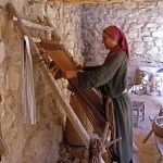
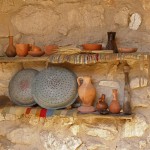
On hillside farm terraces growing olives, figs and pomegranates, visitors can encounter a shepherd tending his flock, a carpenter using his tools and a weaver demonstrating her craft.

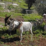
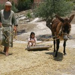
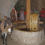
As the seasons pass, a farmer breaks open the ground with a plough pulled by donkeys, crops are planted and pruned, olives are harvested and pressed, grapes are picked and crushed by foot, and wheat is cut and threshed.

There is a watchtower, a quarry, an irrigation system and a village synagogue that accurately replicates a first-century Jewish house of worship.

In this parable-rich environment, in-character villagers in authentic costumes demonstrate farming practices and talk about their daily life and work as they relate to the Gospels.


A working farm in Jesus’ time

Nazareth Village opened in 2000 as the fulfillment of a long-held vision of Dr Nakhle Bishara, medical director of the adjacent Nazareth Hospital and a local historian.

Nazareth Village

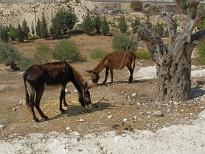
Donkeys grazing at Nazareth Village (Seetheholyland.net)

It occupies a 6-hectare site that was previously vacant hospital land. Archaeologists have confirmed the site would have been a working terrace farm in Jesus’ time, probably the property of a single extended family.

Scholarly research led by experts from the Jerusalem-based University of the Holy Land underpinned the project. Village buildings were erected in stone, using first-century construction methods.

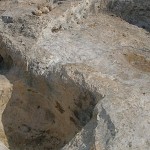
An early archaeological discovery was an ancient man-made basin, cut into the bedrock, that was used for making wine. This level area where grapes were treaded had a channel leading to a pit where the runoff juice was collected.

Pottery from as far back as the Early Bronze Age — more than 2000 years before Christ — was found on the site.


Meals of first-century foods

Nazareth Village

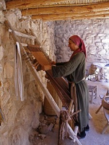
Weaving on a loom at Nazareth Village (Seetheholyland.net)

Nazareth Village is a non-profit Christian enterprise. It is backed by an interdenominational collection of locals and international identities such as former United States president Jimmy Carter and singer Pat Boone, and volunteers from around the world join its staff for varying periods of time.

Tours of the village take about an hour and a half, beginning with displays giving the historical context of Jewish life under Roman occupation in the 1st century.

Special-event meals can be arranged for groups, in which typical first-century foods are served with fresh herbs and savoury flat bread in a stone dining area with arched spans.

A gift shop offers a range of products linked to the life of Jesus, including books, art, costumes, frankincense, nard and mustard seeds.

The authentic character of Nazareth Village has often attracted television and movie companies to use it as a setting for period productions.


Other sites in Nazareth:

Nazareth

Church of the Annunciation

Church of St Joseph

Administered by: Nazareth Village Board

Tel.: 972 4 6456042; fax 972 4 6559295

Open: 9am-5pm (last tour begins 3.30pm); closed Sunday, New Year’s Day, Good Friday, Easter Monday, Independence Day, Christmas Day, December 26.


References

Kauffmann, Joel: The Nazareth Jesus Knew (Nazareth Village, 2005)
Pfann, Stephen; Voss, Ross; and Rapuano, Yehudah: “Surveys and Excavations at the Nazareth Village Farm (1997–2002): Final Report”, Bulletin of the Anglo-Israel Archaeological Society, volume 25 (2007)
Smith, David: “Where it happened”, The Jerusalem Post Christian Edition, December 2007
Walker, Peter: In the Steps of Jesus (Zondervan, 2006)


External links

Nazareth Village
« Newer PostsOlder Posts »

Tomb of King David

Jerusalem


One of the holiest sites for Jews is the building on Mount Zion known as the Tomb of King David — the celebrated Old Testament warrior king of Israel who is traditionally credited with composing many of the Psalms.

King David's Tomb after extensive renovations were completed in 2014 (Seetheholyland.net)

King David’s Tomb after extensive renovations were completed in 2013 (Seetheholyland.net)

The Old Testament clearly indicates that David was buried somewhere else. However, the site — directly underneath the Cenacle, where Christians commemorate the Last Supper — remains a place of pilgrimage for Jews, Muslims and Christians.

David’s death at the end of his 40-year reign is recorded in 1 Kings 2:10: “Then David slept with his ancestors and was buried in the city of David.”

Archaeologists have shown that the City of David, also called Zion (or Sion), was the low spur south of the Temple Mount and east of the present Mount Zion.

This area, also known as Ophel, is now known to have been the original Jerusalem — making it much older than what is now called the Old City.

But excavations here since the 1800s have failed to identify the royal tomb. (Another tradition places the burial of David in Bethlehem, but excavations have not revealed the tomb there either.)


Temple Mount moved across the valley

Tomb of King David

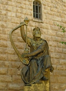
Statue of King David outside the Tomb of King David (Seetheholyland.net)

How did the confusion over David’s burial place arise? There are two likely reasons.

• First, perhaps at the time Solomon built his Temple, the Temple Mount came to be called Mount Zion. In the first century AD, following the Roman destruction of Jerusalem, the name was transferred to its present location across the Tyropoeon Valley.

Until excavations in the 19th century, archaeologists believed that the city of David was on this hill too.

• In the 10th century a belief that David’s tomb was on the present Mount Zion began to develop among Christian pilgrims, who celebrated David’s memory along with that of St James, the first bishop of Jerusalem.

It was actually the Christian Crusaders who built the present Tomb of David with its large stone cenotaph. However, three of the walls of the room where the cenotaph stands are much older — apparently from a synagogue-church used by first-century Judaeo-Christians, which became known as the Church of the Apostles.

Gradually this memorial came to be accepted as David’s tomb, first by the Jews and later also by Muslims.


Sarcophagus is empty

Tomb of King David

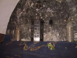
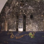
Torah case in niche over Tomb of King David (Picturesfree.org)

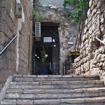
Entry to the Tomb of David is through a courtyard which is part of a former Franciscan monastery that was closed in 1551.

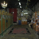
The complex has three simple rooms, all without furniture except for wooden benches.

The entrance hall is used as a synagogue. There is a Christian tradition that this is where Christ washed his disciples’ feet during the Last Supper.

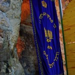
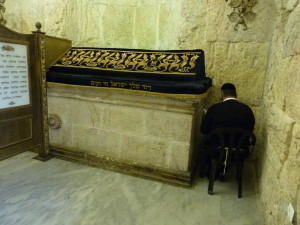
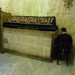
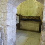
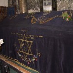
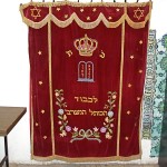
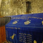
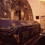
The massive cenotaph stands in front of a niche blackened by pilgrims’ candles. Over it is draped a velvet cloth with embroidered stars of David and inscriptions from the Jewish Scriptures. On it are scrolls of the Torah (the first five books of the Hebrew Bible) in ornate cases.
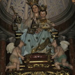
The cenotaph is an empty sarcophagus. In 1859 an Italian engineer, Ermete Pierotti, investigated the tomb and reported that underneath was a small, shallow and empty cave.


Special significance until 1967

The Tomb of David was of special significance to Jews between 1948, when the state of Israel was founded, and 1967.

During this period the Old City was under Jordanian control and there was no access to the Western Wall of the Temple Mount. Since Mount Zion was in Israeli control, Jews would come to the Tomb of David to pray.


In Scripture:

King David’s last words: 2 Samuel 23:1-7

King David’s death: 1 Kings 2:10

King David’s reign: 1 Chronicles 29:26-30


Administered by: Israel Ministry of Religious Services

Tel.: 972-2-5388605

Open: 8am-sunset (closes on Fridays at 2pm Apr-Sep and 1pm Oct-Mar). Men and women are separated. Men should cover their heads (kippahs are provided).


References

Gonen, Rivka: Biblical Holy Places: An illustrated guide (Collier Macmillan, 1987)
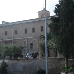
Inman, Nick, and McDonald, Ferdie (eds): Jerusalem & the Holy Land (Eyewitness Travel Guide, Dorling Kindersley, 2007)
Mackowski, Richard M.: Jerusalem: City of Jesus (William B. Eerdmans, 1980)
Poni, Shachar: “Renovating Royal Tomb” (The Jewish Voice, February 5, 2010)
Wareham, Norman, and Gill, Jill: Every Pilgrim’s Guide to the Holy Land (Canterbury Press, 1996)


External links

King David’s Traditional Tomb (CenturyOne Foundation)
Church of the Apostles found on Mt Zion (Century One Foundation)
« Newer PostsOlder Posts »

Madaba

Jordan

Madaba

Guide explains mosaic map in Church of St George, Madaba (Seetheholyland.net)

The remains of the oldest known map of the Holy Land, painstakingly assembled from more than a million pieces of coloured stone, lie on the floor of a church in the Jordanian city of Madaba.

This unique art treasure was designed by an unknown artist and constructed in a Byzantine cathedral in the middle of the 6th century.

It was rediscovered only in 1884, but its unique character was recognised only in 1896, after the new Greek Orthodox Church of St George had been built over it.

The discovery of the Madaba Mosaic Map, and mosaics in the remains of five more churches and other locations in the town, led to Madaba, 30km south of Amman, becoming known as “the City of Mosaics”.

The map originally covered an area of more than 15.5 metres by 5.5 metres with a geographic sweep from Lebanon in the north to the Nile delta in the south. Less than a third of the map has survived.

In spite of some inaccuracies, it is regarded as the most exact map of the Holy Land before modern cartography was developed.


Jerusalem is the main feature

Madaba

Madaba map showing fish in Jordan River (Dale Gillard)

Unlike modern maps, which face north, the Madaba mosaic is orientated to the east, with the Jordan River flowing from left to right.

Using a palette consisting of coloured stones and glass, the artist ingeniously depicted biblical locations, regional names and events, labelling them with about 150 inscriptions in Greek.

There is Jericho ringed with palm trees, Jacob’s Well at Shechem, the Oak of Mamre at Hebron, John’s baptism of Jesus in the Jordan River, and the allotments of the 12 tribes of Israel.

East of the Jordan River, a lion pursues a graceful gazelle. Fish swim down the river, with one turning back against the flow to avoid the poisonous Dead Sea. Two pulley-drawn ferries cross the river. Two boats cross the Dead Sea, one being rowed and the other under sail.

But the artist’s dominant focus is on the “Holy City” of Jerusalem. A lavish bird’s-eye view of the city is presented, with its walls, gates, main streets and 36 specific buildings represented. Many of the buildings (including the Church of the Holy Sepulchre) are clearly identifiable.
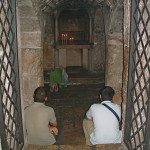
 

Purpose of map is debated

Scholars have differing opinions on why such an expensive piece of religious art should have been commissioned by Church authorities on the floor of a Christian building in a provincial town of the Roman Empire.

St George's Church, Madaba (Seetheholyland.net)
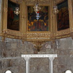
St George’s Church, Madaba (Seetheholyland.net)

Some of the possibilities debated are:

• To aid pilgrims in making their way from one holy place to another. But pilgrims could not take this map with them, and portable maps and local guides were available at the time.

• To represent Moses’ vision of the Promised Land. Moses glimpsed the Promised Land from the top of nearby Mount Nebo, and Madaba was the episcopal see of the bishopric to which Mount Nebo belonged.

• To enhance the spiritual experience of worshippers during liturgy. The mosaic was originally on the floor of a large church, stretching across between the priest at the altar and the congregation.

The contents of the map indicate that it was intended as a work of biblical geography, probably based on the Onomasticon of Eusebius, a gazatteer of placenames, as well as on pilgrims’ journals and the artist’s own knowledge of the land.

The importance given to Christian holy places, especially the Church of the Holy Sepulchre, rather than Old Testament locations, suggests that the map is a Christian exposition of the message of salvation in a geographic context.


Madaba in ruins for centuries

Madaba

Mosaic map in Church of St George (© Visitpalestine.ps)

Madaba was an important town in the early centuries of the Christian era. It was on the King’s Highway trade route, it had its own bishop and it had about 10 other churches with impressive mosaics. The remains of two of these churches are in the city’s archaeological park.

A conservative estimate is that the mosaic map would have originally contained about 1,116,000 pieces of stone and glass. A team of three workmen, working 10-hour days and directed by a superior artist, would have needed about 186 days to assemble it.

In 746, about 200 years after the mosaic map was constructed, Madaba was largely destroyed by an earthquake and subsequently abandoned.

The town was still in ruins and uninhabited in the early 1880s when a group of Christians from Karak, 140km south of Amman, decided to move there to escape conflict with Muslims in their home town.

The new settlers were removing debris from an old church in 1884, so they could build a new one on the site, when they discovered the remains of the map. They incorporated the surviving fragments into the new St George’s Church.

The map’s extraordinary value was not recognized until the librarian of the Greek Orthodox patriarchate in Jerusalem, Fr Kleopas Koikylides, visited in 1896. A report he published the following year brought international attention to the dusty village of Madaba.

By the middle of the 19th century the mosaic was in poor condition. Restoration and conservation was carried out by archaeologists Herbert Donner and Heinz Cüppers in 1965.

Madaba is now the fifth most populous city in Jordan and the administrative centre for the territory south of Amman. St George’s Church is northwest of the city centre.


Administered by: Greek Orthodox Church

Tel.: 962-5-324-4984

Open: Sat, Mon-Thur 8am-6pm; Fri 9.30am-6pm; Sun 10.30am-6pm (5pm closing in winter)


References

Donner, Herbert: The Mosaic Map of Madaba: an introductory guide (Kok Pharos, 1992)
Haddad, Fadi Shawkat: A Christian Pilgrimage Journey in Jordan (published by author, PO Box 135, Amman 11733, 2015)
Inman, Nick, and McDonald, Ferdie (eds): Jerusalem & the Holy Land (Eyewitness Travel Guide, Dorling Kindersley, 2007)
Piccirillo, Michele: “The Madaba Mosaic Map”, Holy Land, winter 2002


External links

Madaba (Wikipedia)
Madaba (VisitJordan)
« Newer PostsOlder Posts »
All content © 2022, See the Holy Land | Site by Ravlich Consulting & Mustard Seed
You are welcome to promote site content and images through your own
website or blog, but please refer to our Terms of Service | Login